|
search place name
|
||
Ajorai (North-West Frontier, Pakistan)Ajorai is a town in the North-West Frontier region of Pakistan. An overview map of the region around Ajorai is displayed below.
regional and 3d topo map of Ajorai, Pakistan ::

Ajorai airports ::
The nearest airport is SDT - Saidu Sharif, located 31.6 km south west of Ajorai.
Other airports nearby include MFG - Muzaffarabad (112.5 km south east), PEW - Peshawar Intl (150.8 km south west), ISB - Islamabad Chaklala (162.1 km south), RAZ - Rawala Kot Rawalakot (170.2 km south east), Nearby towns ::
Bāqi Bānda (1.1km west) //
Jahannamsar (2.2km south east) //
Gatsar Bānda (2.9km north east) //
Tordaup (3.3km east) //
Tīr (3.3km east) //
Pitāo Kas (3.7km south east) //
Pīr Gāndai (4.0km south west) //
Gumkat Bānda (4.4km south) //
Banpakia (3.7km west) //
Arkhūna (4.3km north west) //
Shilār (3.9km north east) //
Kūh (4.0km south west) //
Shalkhi Bānda (4.4km south east) //
Mullāno Cham (4.4km north west) //
Bar Karingal (4.9km south) //
Sorai Kas (4.2km east) //
Kas (4.4km south east) //
Miāndam (5.0km north west) //
Mangāzai (5.0km north east) //
Shūmān (4.9km north east) //
Kuz Karingal (5.6km south) //
Dre (5.2km south east) //
Barkhai (5.7km north west) //
Shīno (5.8km south east) //
Sar Bānda (5.9km north) //
Spīn Kas (5.0km east) //
Kanda (5.4km north east) //
Baret (6.1km south) //
Ashārai (6.1km south) //
[all distances 'as the bird flies' and approximate] 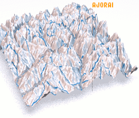 Places with similar names to Ajorai, Pakistan ::
Disclaimer :: Information on this page comes without warranty of any kind |
||
|
Where is Ajorai? Elevation and coordinates ::
Latitude (lat): 35°1'0"N Longitude (lon): 72°35'45"E
Elevation (approx.): 2984m (map arrows pan, magnifying glasses zoom) |
||
|
Visiting Ajorai? Hotel/Accommodation ::
Book a hotel in Ajorai Travel Guide ::
Buy a travel guide for Pakistan rental cars ::
car rental offers GPS waypoint ::
download a GPX waypoint (PoI) of Ajorai for your GPS receiver
|
||