|
search place name
|
||
Akbar ke Kāthia (Punjab, Pakistan)Akbar ke Kāthia is a town in the Punjab region of Pakistan. An overview map of the region around Akbar ke Kāthia is displayed below.
regional and 3d topo map of Akbar ke Kāthia, Pakistan ::

Akbar ke Kāthia airports ::
The nearest airport is LYP - Faisalabad Intl, located 93.5 km north of Akbar ke Kāthia.
Other airports nearby include MUX - Multan Intl (125.5 km west), LHE - Lahore Allama Iqbal Intl (197.3 km north east), Nearby towns ::
Bāgar (1.0km north) //
Thatta Khān (1.0km north) //
Hayāt ke Kāthia (2.0km north east) //
Kotla Jinda Rām (2.1km south west) //
Nawāb Kāthia (2.1km north west) //
Chak One Hundred Thirteen-Seven BR (2.5km south) //
Chak One Hundred Twelve-Seven BR (2.4km south east) //
Amirbur (2.5km west) //
Alluāna (2.6km north west) //
Chak Seven Hundred Thirty-two GB (3.1km north) //
Mallāwala Bhaini (3.3km east) //
Thatta Sarwar (3.4km east) //
Chak One Hundred Fourteen-Seven BR (3.9km south west) //
Thatta Ghulle (3.7km west) //
Thatta Saiyidān (4.0km north east) //
Khānwāla Tibba (4.4km north east) //
Chak Sher Singh (4.4km north west) //
Thatta Mazam (4.3km west) //
Chak Seven Hundred Thirty-six GB (5.3km north) //
Buddhat Jhalār (4.8km west) //
Charnāla (5.8km north) //
Kalera Kalān (5.3km north east) //
Chak Ten-Thirteen L (5.7km south west) //
Chak One Hundred Eleven-Seven AR (5.3km east) //
Bakhu Sanpāl (5.8km north west) //
Chak Seven Hundred Thirty-eight GB (6.2km north) //
Chak One Hundred Ten-Twelve L (6.2km south east) //
Chak Seven Hundred Thirty-seven GB (6.1km north east) //
Jhalār Ghāzi Sanpāl (5.9km west) //
[all distances 'as the bird flies' and approximate] 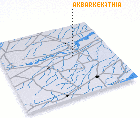 Places with similar names to Akbar ke Kāthia, Pakistan :: Disclaimer :: Information on this page comes without warranty of any kind |
||
|
Where is Akbar ke Kāthia? Elevation and coordinates ::
Latitude (lat): 30°34'30"N Longitude (lon): 72°39'10"E
Elevation (approx.): 160m (map arrows pan, magnifying glasses zoom) |
||
|
Visiting Akbar ke Kāthia? Hotel/Accommodation ::
Book a hotel in Akbar ke Kāthia Travel Guide ::
Buy a travel guide for Pakistan rental cars ::
car rental offers GPS waypoint ::
download a GPX waypoint (PoI) of Akbar ke Kāthia for your GPS receiver
|
||