|
search place name
|
||
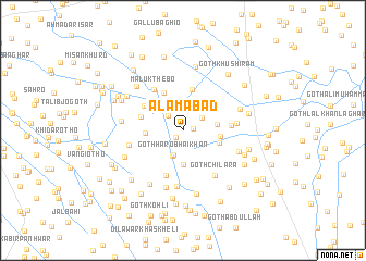
Ālamābād (Sind, Pakistan)Ālamābād is a town in the Sind region of Pakistan. An overview map of the region around Ālamābād is displayed below.
regional and 3d topo map of Ālamābād, Pakistan ::
Ālamābād airports ::
The nearest airport is BDN - Talhar, located 60.2 km south of Ālamābād.
Other airports nearby include WNS - Nawabshah (109.7 km north west), KHI - Karachi Jinnah Intl (188.6 km west), MJD - Moenjodaro (232.1 km north), JSA - Jaisalmer (253.9 km north east), Nearby towns ::
Hāji Muhammad Ali Shāh (1.0km south west) //
Kangar (1.0km east) //
Khān Muhammad Laghāri (2.1km north west) //
Goth Maulvi (2.2km north east) //
Goth Haro Bhai Khān (2.6km south) //
Muhammad Ali (2.7km north) //
Bijār Laghāri (2.8km south) //
Mīr Faqīr Muhammad (3.1km north) //
Goth Allāhyār (3.6km south) //
Lāla Panjābi (3.3km east) //
Shādi (3.5km west) //
Mewo Laghāri (3.6km east) //
Goth Seth Qāsim (3.5km east) //
Tāj Muhammad Khāskheli (4.3km north) //
Pīr Muhammad Hāshim (4.3km north west) //
Goth Muhammad Dīn (4.1km north east) //
Goth Muhammad Sulaimān (4.1km west) //
Bābu Thebo (4.4km north west) //
Wadero Abdullāh Hālipota (4.9km south) //
Goth Lāl Bakhsh Laghāri (4.5km east) //
Malūk Thebo (4.9km north west) //
Goth Kamal Shāh (5.1km east) //
Goth Chilāra (5.5km south east) //
Chaudhri Rashīd Ahmad (5.7km south) //
Shāhu Laghāri (5.3km west) //
Goth Naimat Khān Muhājir (5.6km south east) //
Deh Lūtka (6.1km south) //
Goth Rasūl Khān (5.7km east) //
Dhanīparto Jarwār (5.8km west) //
[all distances 'as the bird flies' and approximate] 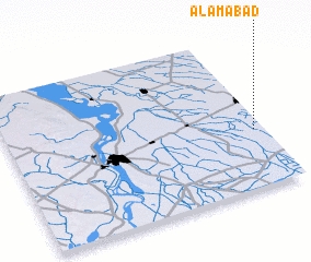 Places with similar names to Ālamābād, Pakistan ::
Disclaimer :: Information on this page comes without warranty of any kind |
||
|
Where is Ālamābād? Elevation and coordinates ::
Latitude (lat): 25°22'25"N Longitude (lon): 68°57'35"E
Elevation (approx.): 22m (map arrows pan, magnifying glasses zoom) |
||
|
Visiting Ālamābād? Hotel/Accommodation ::
Book a hotel in Ālamābād Travel Guide ::
Buy a travel guide for Pakistan rental cars ::
car rental offers GPS waypoint ::
download a GPX waypoint (PoI) of Ālamābād for your GPS receiver
|
||