|
search place name
|
||
Amirpur (Punjab, Pakistan)Amirpur is a town in the Punjab region of Pakistan. An overview map of the region around Amirpur is displayed below.
regional and 3d topo map of Amirpur, Pakistan ::

Amirpur airports ::
The nearest airport is LYP - Faisalabad Intl, located 48.9 km north east of Amirpur.
Other airports nearby include MUX - Multan Intl (149.5 km south west), LHE - Lahore Allama Iqbal Intl (177.4 km east), Nearby towns ::
Rām Lachhman (1.6km east) //
Amirpur (1.6km west) //
Dāl Singhwāla (1.6km west) //
Nijharpur (2.4km south east) //
Nūrpur (3.7km north) //
Kāla Pahār (3.2km west) //
Thatke (3.7km north west) //
Chandu Wadāla (4.0km south east) //
Mārūkwāla (4.0km south west) //
Pairewāl (4.9km north east) //
Talwāndi Pahārang (4.9km north west) //
Jaimal Singh (4.9km south west) //
Khākha (4.8km east) //
Purānawāhla (4.8km west) //
Taqqipur (5.1km west) //
Kot Farquharson (5.8km north) //
Bilasur (5.1km west) //
Jama Rāi (5.1km east) //
Surāngi (5.8km north) //
Bhukike (5.8km north) //
Kot Said Mahmūd (5.8km south) //
Robertsar (6.4km north east) //
Gamtāla (6.4km south west) //
Punnun Pind (6.0km south east) //
Kotli Bajwa (6.0km south west) //
Durānpur (7.6km north) //
Padhri (6.6km east) //
Saroke (7.6km north) //
Randiān (6.6km west) //
[all distances 'as the bird flies' and approximate] 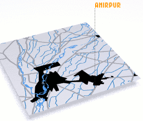 Places with similar names to Amirpur, Pakistan ::
Disclaimer :: Information on this page comes without warranty of any kind |
||
|
Where is Amirpur? Elevation and coordinates ::
Latitude (lat): 31°4'0"N Longitude (lon): 72°37'0"E
Elevation (approx.): 166m (map arrows pan, magnifying glasses zoom) |
||
|
Visiting Amirpur? Hotel/Accommodation ::
Book a hotel in Amirpur Travel Guide ::
Buy a travel guide for Pakistan rental cars ::
car rental offers GPS waypoint ::
download a GPX waypoint (PoI) of Amirpur for your GPS receiver
|
||