|
search place name
|
||
Asgharābād (Sind, Pakistan)Asgharābād is a town in the Sind region of Pakistan. An overview map of the region around Asgharābād is displayed below.
regional and 3d topo map of Asgharābād, Pakistan ::

Asgharābād airports ::
The nearest airport is BDN - Talhar, located 30.8 km west of Asgharābād.
Other airports nearby include WNS - Nawabshah (174.6 km north west), BHJ - Bhuj (175.7 km south), KHI - Karachi Jinnah Intl (200.3 km west), IXY - Kandla (210.7 km south east), Nearby towns ::
Khabbar Chhajro (1.0km south east) //
Hassan Bhān (1.2km east) //
Goth Allāhne Māchhi (1.6km south) //
Ahmad Panhwar (2.0km east) //
Piāre Khān Lund (2.1km north east) //
Umar Dal (2.3km south west) //
Goth Allāh Bakhsh Māchhi (2.3km south east) //
Khuda Bakhsh Rind (2.3km north west) //
Gul Muhammad Amdani (2.6km south) //
Shāhadād Rind (2.5km west) //
Majnūh Junejo (2.9km south west) //
Budho Rind (3.1km north west) //
Ahmad Odejo (3.2km north east) //
Mūsa Kerio (3.2km north west) //
Dalel Amdāni (3.7km south) //
Dāno Junejo (3.5km north east) //
Masti Kapri (3.8km south west) //
Ghāzi Unar (4.2km south west) //
Goth Fazāl Amdāni (4.5km south) //
Dino Khāskheli (4.3km west) //
Siddīq Gāho (4.7km north east) //
Rawat Chāndia (4.8km north) //
Bakhshu Lund (4.5km east) //
Pannu Chāndia (5.0km north) //
Kandho Sānd (4.7km north east) //
Goth Sehta (5.0km south east) //
Bhūre Shāh (5.1km south east) //
Bahādur Lund (5.1km west) //
Abdullāh Juneja (5.1km east) //
[all distances 'as the bird flies' and approximate] 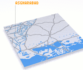 Places with similar names to Asgharābād, Pakistan ::
// Aşgharābād (IR)
// Aşgharābād (IR)
// Aşgharābād (IR)
// Aşgharābād (IR)
// Aşgharābād (IR)
// Aşgharābād (IR)
// Aşgharābād (IR)
// Aşgharābād (IR)
// Aşgharābād (IR)
// Aşgharābād (IR)
Disclaimer :: Information on this page comes without warranty of any kind |
||
|
Where is Asgharābād? Elevation and coordinates ::
Latitude (lat): 24°47'50"N Longitude (lon): 69°8'20"E
Elevation (approx.): 9m (map arrows pan, magnifying glasses zoom) |
||
|
Visiting Asgharābād? Hotel/Accommodation ::
Book a hotel in Asgharābād Travel Guide ::
Buy a travel guide for Pakistan rental cars ::
car rental offers GPS waypoint ::
download a GPX waypoint (PoI) of Asgharābād for your GPS receiver
|
||