|
search place name
|
||
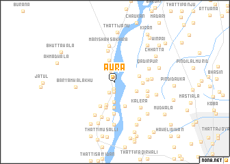
Aura (Punjab, Pakistan)Aura is a town in the Punjab region of Pakistan. An overview map of the region around Aura is displayed below.
regional and 3d topo map of Aura, Pakistan ::
Aura airports ::
The nearest airport is LYP - Faisalabad Intl, located 86.1 km east of Aura.
Other airports nearby include MUX - Multan Intl (164.9 km south west), Nearby towns ::
Chhotiwāla (1.2km south) //
Butta (1.5km south) //
Muhammadwāla (1.6km south) //
Hāji Shāhwāla (1.9km north) //
Thatti Suān (2.0km south west) //
Gorha (2.3km north) //
Shiāhwāla (3.0km north) //
Paropi (3.3km south) //
Thatti Mahrāni (3.3km south) //
Māri Shāh Sukhān (3.6km north) //
Laghār (3.3km south east) //
Muhammadwala (3.9km south) //
Chāndia Nasheb (3.5km east) //
Sāliwāla (4.2km south) //
Thatta Miāna (4.2km south) //
Machhiwāla (4.4km south) //
Mastiāla (3.9km east) //
Hayātwāla (4.4km south west) //
Bibrān (5.1km north) //
Bela (5.2km south) //
Thatti Gul (5.2km south) //
Chāndia Farāz (4.6km east) //
Mal Sultān (4.8km east) //
Sabbar (5.0km south east) //
Māri Shāh Sakhīra (5.9km north) //
Kalera (5.6km south east) //
Qādirpur (5.2km north east) //
Dauka (5.2km east) //
Chāndno (6.0km south) //
[all distances 'as the bird flies' and approximate] 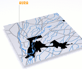 Places with similar names to Aura, Pakistan ::
Disclaimer :: Information on this page comes without warranty of any kind |
||
|
Where is Aura? Elevation and coordinates ::
Latitude (lat): 31°33'47"N Longitude (lon): 72°7'7"E
Elevation (approx.): 151m (map arrows pan, magnifying glasses zoom) |
||
|
Visiting Aura? Hotel/Accommodation ::
Book a hotel in Aura Travel Guide ::
Buy a travel guide for Pakistan rental cars ::
car rental offers GPS waypoint ::
download a GPX waypoint (PoI) of Aura for your GPS receiver
|
||