|
search place name
|
||
Ayawāla (Punjab, Pakistan)Ayawāla is a town in the Punjab region of Pakistan. An overview map of the region around Ayawāla is displayed below.
regional and 3d topo map of Ayawāla, Pakistan ::

Ayawāla airports ::
The nearest airport is LYP - Faisalabad Intl, located 154.1 km east of Ayawāla.
Other airports nearby include MUX - Multan Intl (168.7 km south), PZH - Zhob (190.9 km west), ISB - Islamabad Chaklala (261.9 km north east), Nearby towns ::
Umarwāla (0.8km north) //
Sandiwāla (1.2km south west) //
Baliānwāla (1.5km north) //
Gānwānwāla (1.5km north west) //
Hussainwāla (2.0km north east) //
Chistīwāla (2.1km south west) //
Mochiwāla (2.2km north west) //
Miānwāla Kakra (4.0km south west) //
Jakhrānwāla (4.8km south east) //
Sandiānwāla (5.7km south) //
Chak Mahata Khānsar (5.3km west) //
Hiruwāla (5.8km west) //
Birahimwāla (6.6km south west) //
Pauliwāla (7.3km south) //
Jhamat (7.3km north east) //
Gullawāla (7.2km west) //
Adbaddhi (7.1km west) //
Jindewāla (8.3km south) //
Bhutiwāla (8.7km south) //
Jamewāla (7.8km south east) //
Dholiānwāla Khu (8.4km south east) //
Mamduwāla (8.8km south east) //
Sarangwāla (9.2km south east) //
[all distances 'as the bird flies' and approximate] 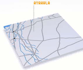 Places with similar names to Ayawāla, Pakistan ::
// Ayiwela (LK)
Disclaimer :: Information on this page comes without warranty of any kind |
||
|
Where is Ayawāla? Elevation and coordinates ::
Latitude (lat): 31°43'30"N Longitude (lon): 71°25'40"E
Elevation (approx.): 174m (map arrows pan, magnifying glasses zoom) |
||
|
Visiting Ayawāla? Hotel/Accommodation ::
Book a hotel in Ayawāla Travel Guide ::
Buy a travel guide for Pakistan rental cars ::
car rental offers GPS waypoint ::
download a GPX waypoint (PoI) of Ayawāla for your GPS receiver
|
||