|
search place name
|
||
Azim Bānda (North-West Frontier, Pakistan)Azim Bānda is a town in the North-West Frontier region of Pakistan. An overview map of the region around Azim Bānda is displayed below.
regional and 3d topo map of Azim Bānda, Pakistan ::

Azim Bānda airports ::
The nearest airport is PEW - Peshawar Intl, located 88.8 km north east of Azim Bānda.
Other airports nearby include JAA - Jalalabad (111.0 km north), KBL - Kabul Intl (194.7 km north west), SDT - Saidu Sharif (207.7 km north east), Nearby towns ::
Kharki (0.7km south west) //
Sra Azmaka (1.6km north west) //
Pungi (2.0km south) //
Khezu Bānda (2.9km east) //
Sāwan Bānd (3.1km west) //
Ghulam Khan Bānda (3.3km west) //
Sarozai (4.2km west) //
Kāhi (5.2km north east) //
Marufi Bānda (5.1km west) //
Dūrhāi (6.7km north) //
Sanghar Bānda (6.2km north west) //
Nariāb (6.7km north west) //
Tari Bānda (7.1km south east) //
Bakar Bānda (7.9km north east) //
Kotemanj (8.6km north west) //
Sharki Bānda (10.3km south west) //
Niāze Bānda (10.9km south west) //
[all distances 'as the bird flies' and approximate] 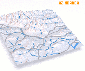 Places with similar names to Azim Bānda, Pakistan ::
// Azmanat (MA)
// Ašminta (LT)
// Azmanite (BG)
// Āsmāndi (BD)
// Assoumanda (BJ)
// Azīm Bānda (PK)
// Asemendi (ES)
// Azim Bānda (PK)
// Asomante (DO)
// Aisémont (BE)
Disclaimer :: Information on this page comes without warranty of any kind |
||
|
Where is Azim Bānda? Elevation and coordinates ::
Latitude (lat): 33°26'13"N Longitude (lon): 70°49'35"E
Elevation (approx.): 950m (map arrows pan, magnifying glasses zoom) |
||
|
Visiting Azim Bānda? Hotel/Accommodation ::
Book a hotel in Azim Bānda Travel Guide ::
Buy a travel guide for Pakistan rental cars ::
car rental offers GPS waypoint ::
download a GPX waypoint (PoI) of Azim Bānda for your GPS receiver
|
||