|
search place name
|
||
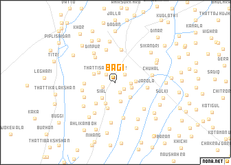
Bagi (Punjab, Pakistan)Bagi is a town in the Punjab region of Pakistan. An overview map of the region around Bagi is displayed below.
regional and 3d topo map of Bagi, Pakistan ::
Bagi airports ::
The nearest airport is LYP - Faisalabad Intl, located 89.4 km south east of Bagi.
Other airports nearby include ISB - Islamabad Chaklala (201.4 km north), MUX - Multan Intl (209.3 km south west), RAZ - Rawala Kot Rawalakot (254.5 km north east), Nearby towns ::
Chandi (1.5km south east) //
Mahabpur (1.8km south) //
Thatti Said Shāhmir (1.8km north west) //
Dhul (1.9km north east) //
Todarpur (1.9km south west) //
Sardārwāla (2.1km east) //
Chogi (2.4km east) //
Retre (2.8km north west) //
Dhup Sari (3.2km south) //
Chak Dhul (2.8km east) //
Siāl (3.1km south west) //
Kikrani (3.2km south east) //
Hindwān (3.3km north west) //
Mete (3.7km south) //
Salika (4.3km south) //
Puhla (4.4km south west) //
Kela Jāgīr (4.3km west) //
Jarola (4.5km east) //
Kāngra (4.9km north west) //
Sāhīwāl (5.3km north) //
Thatti Shāhni (5.5km north) //
Thatti Yāru (4.8km west) //
Thatti Umar (5.0km south west) //
Shāh Chirāghwāla (5.9km south) //
Dīnpur (5.6km north west) //
Badar Bhon (5.7km south west) //
Chuhal (5.2km east) //
Jhok Muhammad Hayāt (5.8km south east) //
Ladhāl (5.9km south west) //
[all distances 'as the bird flies' and approximate] 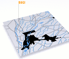 Places with similar names to Bagi, Pakistan ::
Disclaimer :: Information on this page comes without warranty of any kind |
||
|
Where is Bagi? Elevation and coordinates ::
Latitude (lat): 31°55'32"N Longitude (lon): 72°19'0"E
Elevation (approx.): 169m (map arrows pan, magnifying glasses zoom) |
||
|
Visiting Bagi? Hotel/Accommodation ::
Book a hotel in Bagi Travel Guide ::
Buy a travel guide for Pakistan rental cars ::
car rental offers GPS waypoint ::
download a GPX waypoint (PoI) of Bagi for your GPS receiver
|
||