|
search place name
|
||
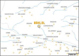
Bahlol (Balochistān, Pakistan)Bahlol is a town in the Balochistān region of Pakistan. An overview map of the region around Bahlol is displayed below.
regional and 3d topo map of Bahlol, Pakistan ::
Bahlol airports ::
The nearest airport is UET - Quetta, located 122.2 km south west of Bahlol.
Other airports nearby include PZH - Zhob (166.2 km east), KDH - Kandahar (185.9 km west), Nearby towns ::
Bazār (1.0km north) //
Loe Aghbang (3.7km east) //
Sakhi Ziārat (4.7km south) //
Urghar (4.1km west) //
Tāl (6.3km south) //
Gilwandai (5.8km south east) //
Ahdekai (6.1km east) //
Kārez (6.9km south east) //
Jerpānr (6.9km north west) //
Chingai (7.2km south) //
Nigand (7.3km south west) //
Sharan Murgha (7.5km south east) //
Shīn Kats (8.3km south) //
Zhar Ghez (8.3km south) //
Murgha Faqīrzai (8.1km south east) //
Qutb Skhobai (8.4km north west) //
Khāna Murgha (9.5km north east) //
Wali Khān (9.0km north west) //
Kharzun (9.7km south east) //
Tsogai Shabān (10.1km north west) //
Parshagai Hābo (10.4km north west) //
Zangal (10.5km south east) //
[all distances 'as the bird flies' and approximate] 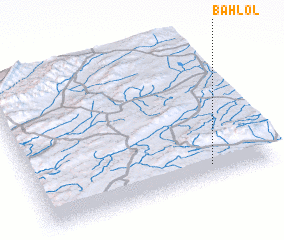 Places with similar names to Bahlol, Pakistan ::
Disclaimer :: Information on this page comes without warranty of any kind |
||
|
Where is Bahlol? Elevation and coordinates ::
Latitude (lat): 31°6'20"N Longitude (lon): 67°44'40"E
Elevation (approx.): 2363m (map arrows pan, magnifying glasses zoom) |
||
|
Visiting Bahlol? Hotel/Accommodation ::
Book a hotel in Bahlol Travel Guide ::
Buy a travel guide for Pakistan rental cars ::
car rental offers GPS waypoint ::
download a GPX waypoint (PoI) of Bahlol for your GPS receiver
|
||