|
search place name
|
||
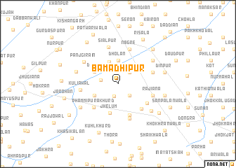
Bamadhipur (Punjab, Pakistan)Bamadhipur is a town in the Punjab region of Pakistan. An overview map of the region around Bamadhipur is displayed below.
regional and 3d topo map of Bamadhipur, Pakistan ::
Bamadhipur airports ::
The nearest airport is LYP - Faisalabad Intl, located 72.7 km north east of Bamadhipur.
Other airports nearby include MUX - Multan Intl (127.2 km south west), LHE - Lahore Allama Iqbal Intl (195.4 km east), Nearby towns ::
Islāmābād (2.1km south) //
Sarāba (2.4km north east) //
Ahmadābād (2.4km south east) //
Bāharwāla (2.5km west) //
Dholan (3.7km north) //
Gatwāla (3.7km north) //
Phammipura Kalān (3.7km south west) //
Dheri (3.8km north west) //
Jhelum (4.8km south) //
Chak Two Hundred Eighty-seven (5.2km south) //
Phammipura Khurd (5.0km south west) //
Arāyān (5.1km south east) //
Sethwāla (5.0km south east) //
Pakki Thatti (5.1km east) //
Rajiāna (5.1km east) //
Allahābād (5.8km south) //
Nāgre (5.8km north) //
Siālpur (6.0km north) //
Kuliāwāl (5.3km west) //
Panjgirāin (5.8km north west) //
Bange Nau (6.0km north east) //
Jattān (6.2km south east) //
Bājra (6.0km west) //
Nangal Kalān (6.4km south west) //
Dīnpur (6.6km east) //
Muhammadābād (6.6km east) //
Bhāgat (7.3km north east) //
Gādhiānwāla (7.2km south east) //
Risāla (7.9km north east) //
[all distances 'as the bird flies' and approximate]  Places with similar names to Bamadhipur, Pakistan :: Disclaimer :: Information on this page comes without warranty of any kind |
||
|
Where is Bamadhipur? Elevation and coordinates ::
Latitude (lat): 30°52'0"N Longitude (lon): 72°30'0"E
Elevation (approx.): 156m (map arrows pan, magnifying glasses zoom) |
||
|
Visiting Bamadhipur? Hotel/Accommodation ::
Book a hotel in Bamadhipur Travel Guide ::
Buy a travel guide for Pakistan rental cars ::
car rental offers GPS waypoint ::
download a GPX waypoint (PoI) of Bamadhipur for your GPS receiver
|
||