|
search place name
|
||
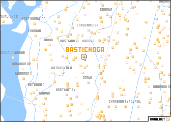
Basti Choga (Punjab, Pakistan)Basti Choga is a town in the Punjab region of Pakistan. An overview map of the region around Basti Choga is displayed below.
regional and 3d topo map of Basti Choga, Pakistan ::
Basti Choga airports ::
The nearest airport is PZH - Zhob, located 144.5 km west of Basti Choga.
Other airports nearby include MUX - Multan Intl (145.2 km south), Nearby towns ::
Bhawānpur (1.1km south) //
Churar (1.4km south) //
Saiyidwāla (1.4km south west) //
Fateh Bhamb (2.0km north west) //
Basti Lākha (2.3km west) //
Hazāra (2.7km south) //
Nahrewāla (2.7km north) //
Nazir Shāhwāla (2.6km south east) //
Kandāni (3.3km north) //
Kachikadhāni (3.0km east) //
Jhok Ata Muhammad (3.4km north west) //
Razāi Shāh (3.6km north east) //
Thethrānwāla (3.7km south east) //
Sālārwāla (3.6km south east) //
Basti Mandrān (4.1km south west) //
Bakhtāwar Basti (3.6km west) //
Fazal Shāhwāla (3.7km east) //
Chhīnawāla (3.9km south east) //
Balochwāla (3.8km south east) //
Longarwāla (3.7km east) //
Shimerwāla (3.8km east) //
Lohāriwāla (3.8km east) //
Basti Jamāl (4.3km north west) //
Ganji (4.8km south) //
Motīwāla (4.8km south east) //
Rashīdpur (5.0km south) //
Dhāndla (4.5km west) //
Jhang (4.5km east) //
Gasora (5.3km north) //
[all distances 'as the bird flies' and approximate]  Places with similar names to Basti Choga, Pakistan ::
Disclaimer :: Information on this page comes without warranty of any kind |
||
|
Where is Basti Choga? Elevation and coordinates ::
Latitude (lat): 31°27'25"N Longitude (lon): 70°58'45"E
Elevation (approx.): 164m (map arrows pan, magnifying glasses zoom) |
||
|
Visiting Basti Choga? Hotel/Accommodation ::
Book a hotel in Basti Choga Travel Guide ::
Buy a travel guide for Pakistan rental cars ::
car rental offers GPS waypoint ::
download a GPX waypoint (PoI) of Basti Choga for your GPS receiver
|
||