|
search place name
|
||
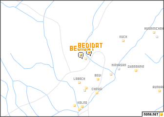
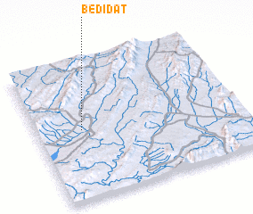
Bedi Dat (Balochistān, Pakistan)Bedi Dat is a town in the Balochistān region of Pakistan. An overview map of the region around Bedi Dat is displayed below.
regional and 3d topo map of Bedi Dat, Pakistan ::
Bedi Dat airports ::
The nearest airport is PJG - Panjgur, located 118.8 km north west of Bedi Dat.
Other airports nearby include PSI - Pasni (232.0 km south west), KHI - Karachi Jinnah Intl (263.9 km south east), Nearby towns ::
 Places with similar names to Bedi Dat, Pakistan ::
// Batī Dīda (ET)
// Bodādīt (IN)
// Beït Dâoud (LB)
// Bedi Dat (PK)
// Batatota (LK)
// Beaudéduit (FR)
// Badī‘at ‘Ūd (OM)
// Biḩdaydāt (LB)
// Baotadadui (CN)
Disclaimer :: Information on this page comes without warranty of any kind |
||
|
Where is Bedi Dat? Elevation and coordinates ::
Latitude (lat): 26°30'58"N Longitude (lon): 65°13'20"E
Elevation (approx.): 612m (map arrows pan, magnifying glasses zoom) |
||
|
Visiting Bedi Dat? Hotel/Accommodation ::
Book a hotel in Bedi Dat Travel Guide ::
Buy a travel guide for Pakistan rental cars ::
car rental offers GPS waypoint ::
download a GPX waypoint (PoI) of Bedi Dat for your GPS receiver
|
||