|
search place name
|
||
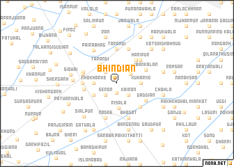
Bhindiān (Punjab, Pakistan)Bhindiān is a town in the Punjab region of Pakistan. An overview map of the region around Bhindiān is displayed below.
regional and 3d topo map of Bhindiān, Pakistan ::
Bhindiān airports ::
The nearest airport is LYP - Faisalabad Intl, located 62.3 km north east of Bhindiān.
Other airports nearby include MUX - Multan Intl (136.3 km south west), LHE - Lahore Allama Iqbal Intl (188.5 km east), Nearby towns ::
Bhaini (1.5km south) //
Shahzāda (2.4km north west) //
Seron (2.4km south west) //
Kairon (2.4km south east) //
Belaggan (2.4km north east) //
Khokharke (3.2km west) //
Kuhārke (3.3km east) //
Risāla (4.0km south) //
Gobindpur (3.7km south west) //
Tarāndi (3.9km north west) //
Davi Despure (4.6km north east) //
Iban Kalān (4.5km north east) //
Haripur (4.9km north east) //
Singhpura (4.9km south east) //
Risāla (4.6km west) //
Dāddiān (4.8km south east) //
Toba Tek Singh (4.8km west) //
Tarandi (5.6km north) //
Bhuier (5.0km west) //
Islāmpur (5.0km west) //
Nāgre (5.8km south) //
Sihowāl (5.8km north) //
Bhāgat (5.8km south) //
Pairābhāg (6.2km north west) //
Gaoshāla (6.1km west) //
Siālpur (6.9km south west) //
Siowāi (6.5km west) //
Rān (7.6km north) //
Bhanguān (6.6km east) //
[all distances 'as the bird flies' and approximate]  Places with similar names to Bhindiān, Pakistan ::
Disclaimer :: Information on this page comes without warranty of any kind |
||
|
Where is Bhindiān? Elevation and coordinates ::
Latitude (lat): 30°58'0"N Longitude (lon): 72°32'0"E
Elevation (approx.): 157m (map arrows pan, magnifying glasses zoom) |
||
|
Visiting Bhindiān? Hotel/Accommodation ::
Book a hotel in Bhindiān Travel Guide ::
Buy a travel guide for Pakistan rental cars ::
car rental offers GPS waypoint ::
download a GPX waypoint (PoI) of Bhindiān for your GPS receiver
|
||