|
search place name
|
||
Bhuran (Sind, Pakistan)Bhuran is a town in the Sind region of Pakistan. An overview map of the region around Bhuran is displayed below.
regional and 3d topo map of Bhuran, Pakistan ::

Bhuran airports ::
The nearest airport is WNS - Nawabshah, located 20.7 km east of Bhuran.
Other airports nearby include MJD - Moenjodaro (122.1 km north), BDN - Talhar (167.7 km south east), SKZ - Sukkur (175.7 km north), KHI - Karachi Jinnah Intl (179.3 km south west), Nearby towns ::
Mir Ewaz (2.5km south east) //
Bāu (2.5km south east) //
Kando (2.5km south east) //
Sukhio Manāhejo (2.5km west) //
Goth Niāzi Siāl (2.9km north) //
Goth Thalu Jām Unar (3.0km south west) //
Goth Gabhar Dāhri (3.3km north) //
Goth Ata Muhammad Wādo (3.2km north east) //
Deh Thity-three (3.5km north east) //
Bachal Rāhu (3.7km south) //
Kānian (3.3km east) //
Goth Yāsīn Punjābi (3.6km north west) //
Goth Bakhar Khān Marri (3.9km north) //
Goth Allāh Rakhio (3.6km north east) //
Masti Chāndio (3.8km south east) //
Chanesar (3.8km north east) //
Rahīmābād (4.4km north) //
Goth Hāji Allāh Bachāyo (4.7km south) //
Goth Salan Khān Zardāri (4.5km north east) //
Goth Ramzān Dahri (4.3km west) //
Goth Dittu Sabki (4.7km north) //
Goth Rahīm Dāhri (4.5km west) //
Goth Amir Punjābi (4.9km north) //
Goth Muhammad Qāsim Mahr (5.1km north) //
Goth Ali Muhammad Marri (5.0km south west) //
Mir Muhammad Juno (5.0km north west) //
Dinu Shāh (5.0km south east) //
Goth Mubārik Lashāri (5.0km north west) //
Goth Mīr Muhammad Sabki (5.3km north) //
[all distances 'as the bird flies' and approximate] 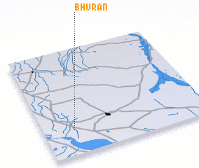 Places with similar names to Bhuran, Pakistan ::
Disclaimer :: Information on this page comes without warranty of any kind |
||
|
Where is Bhuran? Elevation and coordinates ::
Latitude (lat): 26°14'0"N Longitude (lon): 68°11'0"E
Elevation (approx.): 36m (map arrows pan, magnifying glasses zoom) |
||
|
Visiting Bhuran? Hotel/Accommodation ::
Book a hotel in Bhuran Travel Guide ::
Buy a travel guide for Pakistan rental cars ::
car rental offers GPS waypoint ::
download a GPX waypoint (PoI) of Bhuran for your GPS receiver
|
||