|
search place name
|
||
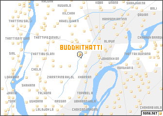
Buddhi Thatti (Punjab, Pakistan)Buddhi Thatti is a town in the Punjab region of Pakistan. An overview map of the region around Buddhi Thatti is displayed below.
regional and 3d topo map of Buddhi Thatti, Pakistan ::
Buddhi Thatti airports ::
The nearest airport is LYP - Faisalabad Intl, located 73.4 km east of Buddhi Thatti.
Other airports nearby include MUX - Multan Intl (155.1 km south west), Nearby towns ::
Naya Thatta (1.5km north east) //
Hasan Khān (2.0km south east) //
Chāh Dheriwāla (2.8km north east) //
Hasan Khān (3.2km south) //
Haweli Shekh Rāju (3.0km south west) //
Kachiān (3.8km north) //
Chāh Korwāla (3.4km east) //
Chūnd Bharwāna (3.6km east) //
Bāli (4.1km north west) //
Chāh Ghānewāla (4.3km north) //
Chak Rasūlpur (4.3km north) //
Thatta Sherka (3.9km east) //
Thatta Ali (4.2km south east) //
Sandrāna (4.4km north east) //
Mallāhān (4.7km south east) //
Chākar (4.6km south west) //
Kharkan (5.6km south) //
Thatta Kauriāna (5.1km north east) //
Dāduāna Nau (5.1km east) //
Chāh Bāliānwāla (5.9km north) //
Chak Hamza (5.7km north east) //
Chāh Massuwāla (6.2km north) //
Janiāna (5.6km west) //
Kot Bura (5.8km west) //
Jahan Khān (5.9km east) //
Chāh Kauriānawāla (6.7km north) //
Alipur (6.3km north east) //
Ziārat Pīr Bahlol (6.8km south west) //
Chak Jalāl-ud-dīn (6.8km south west) //
[all distances 'as the bird flies' and approximate] 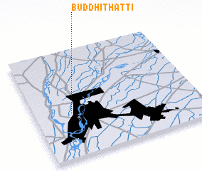 Places with similar names to Buddhi Thatti, Pakistan :: Disclaimer :: Information on this page comes without warranty of any kind |
||
|
Where is Buddhi Thatti? Elevation and coordinates ::
Latitude (lat): 31°25'0"N Longitude (lon): 72°13'30"E
Elevation (approx.): 155m (map arrows pan, magnifying glasses zoom) |
||
|
Visiting Buddhi Thatti? Hotel/Accommodation ::
Book a hotel in Buddhi Thatti Travel Guide ::
Buy a travel guide for Pakistan rental cars ::
car rental offers GPS waypoint ::
download a GPX waypoint (PoI) of Buddhi Thatti for your GPS receiver
|
||