|
search place name
|
||
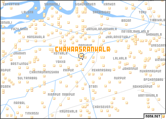
Chāha Asrānwāla (Punjab, Pakistan)Chāha Asrānwāla is a town in the Punjab region of Pakistan. An overview map of the region around Chāha Asrānwāla is displayed below.
regional and 3d topo map of Chāha Asrānwāla, Pakistan ::
Chāha Asrānwāla airports ::
The nearest airport is MUX - Multan Intl, located 59.8 km south west of Chāha Asrānwāla.
Other airports nearby include LYP - Faisalabad Intl (138.9 km north east), Nearby towns ::
Chuprata (0.6km north east) //
Ghasītwāhan (0.6km north east) //
Waluwāla (0.8km west) //
Chāh Muhammadwāla (1.0km south west) //
Chāh Gatwāla (1.6km north west) //
Rukanwāla (1.8km south west) //
Kerwāla (2.3km south) //
Nandpur (2.4km north) //
Chuprata (2.0km east) //
Nankuwāla (2.0km east) //
Purāna Jarma (3.5km south) //
Fatehwāla (3.4km north east) //
Siālānwāla (3.4km south west) //
Manga Viror (3.6km north west) //
Jodhpur (3.8km south east) //
Chak Sultān Mahmūd (3.6km east) //
Chāh Budhewāla (4.2km north west) //
Jasso Kānvin (4.3km north) //
Rāipur (4.3km south west) //
Thulwāla (4.4km south west) //
Rāmpur (4.0km east) //
Chāh Panāhwāla (4.7km north) //
Chāh Thorājānwāla (4.6km north east) //
Mānakwāla (4.6km north east) //
Roshanewāla (4.2km east) //
Chāh Sherewāla (5.1km north) //
Mohriwāla (4.4km west) //
Kotwāla (4.4km west) //
Bilāwalpur (5.2km south) //
[all distances 'as the bird flies' and approximate] 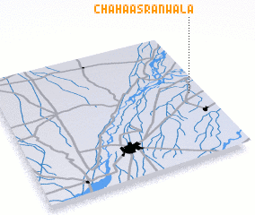 Places with similar names to Chāha Asrānwāla, Pakistan :: Disclaimer :: Information on this page comes without warranty of any kind |
||
|
Where is Chāha Asrānwāla? Elevation and coordinates ::
Latitude (lat): 30°30'45"N Longitude (lon): 71°55'45"E
Elevation (approx.): 137m (map arrows pan, magnifying glasses zoom) |
||
|
Visiting Chāha Asrānwāla? Hotel/Accommodation ::
Book a hotel in Chāha Asrānwāla Travel Guide ::
Buy a travel guide for Pakistan rental cars ::
car rental offers GPS waypoint ::
download a GPX waypoint (PoI) of Chāha Asrānwāla for your GPS receiver
|
||