|
search place name
|
||
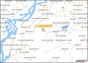
Chāh Māna (Punjab, Pakistan)Chāh Māna is a town in the Punjab region of Pakistan. An overview map of the region around Chāh Māna is displayed below.
regional and 3d topo map of Chāh Māna, Pakistan ::
Chāh Māna airports ::
The nearest airport is LYP - Faisalabad Intl, located 77.7 km south west of Chāh Māna.
Other airports nearby include LHE - Lahore Allama Iqbal Intl (116.0 km south east), ATQ - Amritsar (143.7 km east), IXJ - Jammu (161.6 km north east), ISB - Islamabad Chaklala (179.6 km north), Nearby towns ::
Chak Bahmanowāla (0.5km east) //
Mona Thatta Salābat (1.0km north) //
Tāhli Gurāya (1.6km south east) //
Chāh Bhattiān (2.1km east) //
Kāla Wattu (2.6km north) //
Balocha Wattu (3.1km north east) //
Khurram Lodīka (3.3km north west) //
Khurram Churrera (3.5km west) //
Khurram Jowāya (3.5km west) //
Kudlathi (4.1km north west) //
Qubba Hāji Murād Shāh (4.4km north) //
Kot Mahabbat (4.6km north) //
Dhalke Khurd (4.8km south) //
Nābu Rāri (4.5km east) //
Dhalke Kalān (5.5km south east) //
Burj Musti (5.1km west) //
Sādhūke (5.2km north east) //
Tānpur (5.7km north west) //
Kot Ālam Kalān (5.7km north west) //
Kot Ghāzi Kalān (5.7km north west) //
Kot Ghāzi Khurd (5.7km north west) //
Garhi Abdullah (5.6km north west) //
Thatta Rahmān (6.6km north) //
Chhanni Sultān Shāh (6.4km north west) //
Thatta Sikandar (7.1km north east) //
Thatta Jahād (6.6km south east) //
Garhi Gulla (6.6km west) //
Pisūānwāla (8.3km north) //
Jalālpur Kuhna (7.9km north east) //
[all distances 'as the bird flies' and approximate]  Places with similar names to Chāh Māna, Pakistan ::
Disclaimer :: Information on this page comes without warranty of any kind |
||
|
Where is Chāh Māna? Elevation and coordinates ::
Latitude (lat): 32°0'30"N Longitude (lon): 73°19'10"E
Elevation (approx.): 195m (map arrows pan, magnifying glasses zoom) |
||
|
Visiting Chāh Māna? Hotel/Accommodation ::
Book a hotel in Chāh Māna Travel Guide ::
Buy a travel guide for Pakistan rental cars ::
car rental offers GPS waypoint ::
download a GPX waypoint (PoI) of Chāh Māna for your GPS receiver
|
||