|
search place name
|
||
Chak One Hundred Seventeen ANB (Punjab, Pakistan)Chak One Hundred Seventeen ANB is a town in the Punjab region of Pakistan. An overview map of the region around Chak One Hundred Seventeen ANB is displayed below.
regional and 3d topo map of Chak One Hundred Seventeen ANB, Pakistan ::

Chak One Hundred Seventeen ANB airports ::
The nearest airport is LYP - Faisalabad Intl, located 77.9 km south east of Chak One Hundred Seventeen ANB.
Other airports nearby include LHE - Lahore Allama Iqbal Intl (184.0 km east), ISB - Islamabad Chaklala (193.4 km north), MUX - Multan Intl (219.7 km south west), RAZ - Rawala Kot Rawalakot (242.8 km north east), Nearby towns ::
Ahale Allāhyār Khān (0.9km north west) //
Chak One Hundred Seventeen NB (1.4km south) //
Ahmadpur (1.9km north) //
Karoli (2.7km east) //
Jara (3.1km south west) //
Gango (3.7km north) //
Afghānpur (4.2km south east) //
Muhammadwāla (4.2km north west) //
Mokhal (4.0km east) //
Chak One Hundred Twenty-four NB (4.8km south) //
Chak One Hundred Eight NB (4.9km north east) //
Jarra (4.7km west) //
Dera (4.8km west) //
Chak One Hundred Sixteen NB (5.8km south) //
Chak One Hundred Nineteen NB (5.8km south) //
Chawinda (5.3km north east) //
Chak One Hundred Thirteen NB (5.4km south east) //
Gidar Khadi (5.8km north west) //
Chak One Hundred Nine NB (6.1km north) //
Chak One Hundred Three ANB (6.5km north) //
Chak One Hundred Twenty-three NB (6.6km south) //
Chak One Hundred Fourteen NB (5.8km east) //
Khanjar Khānwāla (6.1km north west) //
Haveli Mekhān (6.1km north west) //
Sādiq (6.1km west) //
Chitror (6.5km south west) //
Chak One Hundred Twenty NB (7.2km south east) //
Alīpur (7.6km south) //
Rurāla (7.0km north east) //
[all distances 'as the bird flies' and approximate] 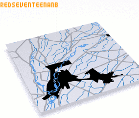 Places with similar names to Chak One Hundred Seventeen ANB, Pakistan ::
// Chak One Hundred - seven (PK)
// Chak One Hundred Seven (PK)
// Chak One Hundred Seven DB (PK)
// Chak One Hundred-seven D N B (PK)
// Chak One Hundred Seven-Fifteen L (PK)
// Chak One Hundred-seven TDA (PK)
// Chak One Hundred-seven TDA (PK)
// Chak One Hundred Seventeen (PK)
// Chak One Hundred Seventeen (PK)
// Chak One Hundred Seventeen DB (PK)
Disclaimer :: Information on this page comes without warranty of any kind |
||
|
Where is Chak One Hundred Seventeen ANB? Elevation and coordinates ::
Latitude (lat): 31°56'30"N Longitude (lon): 72°31'30"E
Elevation (approx.): 179m (map arrows pan, magnifying glasses zoom) |
||
|
Visiting Chak One Hundred Seventeen ANB? Hotel/Accommodation ::
Book a hotel in Chak One Hundred Seventeen ANB Travel Guide ::
Buy a travel guide for Pakistan rental cars ::
car rental offers GPS waypoint ::
download a GPX waypoint (PoI) of Chak One Hundred Seventeen ANB for your GPS receiver
|
||