|
search place name
|
||
Chak One Hundred Twenty-six-Two Fifteen L (Punjab, Pakistan)Chak One Hundred Twenty-six-Two Fifteen L is a town in the Punjab region of Pakistan. An overview map of the region around Chak One Hundred Twenty-six-Two Fifteen L is displayed below.
regional and 3d topo map of Chak One Hundred Twenty-six-Two Fifteen L, Pakistan ::

Chak One Hundred Twenty-six-Two Fifteen L airports ::
The nearest airport is MUX - Multan Intl, located 94.7 km west of Chak One Hundred Twenty-six-Two Fifteen L.
Other airports nearby include LYP - Faisalabad Intl (120.2 km north east), Nearby towns ::
Chak One Hundred Twenty-six-Fifteen L (0.7km north east) //
Chak One Hundred Twenty-six-Four Fifteen L (0.9km south west) //
Islāmābād (1.1km north west) //
Chak One Hundred Twenty-six-Three Fifteen (1.6km south) //
Hamānd (2.0km south east) //
Chak One Hundred Twenty-six-One Fifteen L (2.3km north east) //
Miān Channūn (2.8km north) //
Jarola (2.8km south east) //
Rāmkot (3.1km east) //
Chak One Hundred Twenty-four-Fifteen L (3.5km south) //
Doda (3.6km west) //
Gharībān (4.6km north) //
Hirāj Sanpāl (4.6km south) //
Bharatpur (4.8km north) //
Doghara (4.8km south) //
Chak Forty-seven-Fifteen L (5.2km south east) //
Chak One Hundred Twenty-eight-Fifteen L (5.8km north) //
Kot Rajāna (5.3km north east) //
Angadpur (5.8km south west) //
Lakkānwāla (5.8km north west) //
Lunda (5.8km north west) //
Ali Masjid (6.5km north) //
Siāl Mājra (6.7km south) //
Irshādpur (6.5km north east) //
Burhānpur (6.9km north) //
Sangatpura (6.2km east) //
Giliānwāla (7.1km north east) //
Langar (7.1km south east) //
Bhaini Pathānwāli (7.5km south west) //
[all distances 'as the bird flies' and approximate] 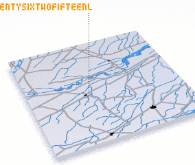 Places with similar names to Chak One Hundred Twenty-six-Two Fifteen L, Pakistan ::
// Chak One Hundred Twenty (PK)
// Chak One Hundred Twenty DB (PK)
// Chak One Hundred-twenty D N B (PK)
// Chak One Hundred Twenty EB (PK)
// Chak One Hundred Twenty-eight (PK)
// Chak One Hundred Twenty-eight (PK)
// Chak One Hundred Twenty-eight BR (PK)
// Chak One Hundred Twenty-eight D N B (PK)
// Chak One Hundred Twenty-eight-Fifteen L (PK)
// Chak One Hundred Twenty-eight P (PK)
Disclaimer :: Information on this page comes without warranty of any kind |
||
|
Where is Chak One Hundred Twenty-six-Two Fifteen L? Elevation and coordinates ::
Latitude (lat): 30°25'30"N Longitude (lon): 72°22'10"E
Elevation (approx.): 152m (map arrows pan, magnifying glasses zoom) |
||
|
Visiting Chak One Hundred Twenty-six-Two Fifteen L? Hotel/Accommodation ::
Book a hotel in Chak One Hundred Twenty-six-Two Fifteen L Travel Guide ::
Buy a travel guide for Pakistan rental cars ::
car rental offers GPS waypoint ::
download a GPX waypoint (PoI) of Chak One Hundred Twenty-six-Two Fifteen L for your GPS receiver
|
||