|
search place name
|
||
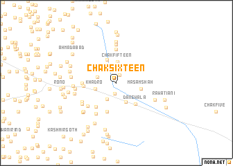
Chak Sixteen (Sind, Pakistan)Chak Sixteen is a town in the Sind region of Pakistan. An overview map of the region around Chak Sixteen is displayed below.
regional and 3d topo map of Chak Sixteen, Pakistan ::
Chak Sixteen airports ::
The nearest airport is WNS - Nawabshah, located 36.3 km west of Chak Sixteen.
Other airports nearby include MJD - Moenjodaro (143.6 km north west), BDN - Talhar (146.2 km south), SKZ - Sukkur (173.3 km north), KHI - Karachi Jinnah Intl (211.3 km south west), Nearby towns ::
Mitha Khān jo Goth (1.3km north) //
Sāīn Bakhsh Rind Khadro (1.7km south) //
Khuda Bakhsh (3.0km south west) //
Mehr Khān Chāng (2.9km west) //
Allāh Bakhsh Buledi (3.2km north west) //
Chak (3.2km north west) //
Chak Fifteen (3.4km north) //
Hāji Jhande Khān (3.4km south east) //
Khadro (3.2km west) //
Darya Khān Buledi (4.0km north) //
Masām Shāh (3.7km east) //
Dānewāla (4.4km south east) //
Nūr Wāh (4.8km south) //
Muhammad Khān Baloch (4.8km south west) //
Mīr Hasan Tālpur (4.7km west) //
Faqīr ka Khu (5.4km north) //
Gul Muhammad Sadwāni (5.0km west) //
Muhammad Ali Borani (5.7km south west) //
Khairu Khān Sanjrāni (5.6km south west) //
Goth Sulemān (6.2km north) //
Abdul Qādir Sanjrāni (5.9km south west) //
Bera Mulla (6.0km south west) //
Muhammad Khān (6.6km north) //
Goth Khizri (6.0km west) //
Chak Twenty-two (6.2km south east) //
Sharf Dīn Baloch (6.3km west) //
Liski (6.6km south west) //
Chaudhry Muhammad Sādiq (6.3km west) //
Hāji Ali Nawāz Baloch Sanjrāni (6.8km south west) //
[all distances 'as the bird flies' and approximate]  Places with similar names to Chak Sixteen, Pakistan ::
// Chak Sixteen (PK)
// Chak Sixteen (PK)
// Chak Sixteen (PK)
// Chak Sixteen (PK)
// Chak Sixteen (PK)
// Chak Sixteen (PK)
Disclaimer :: Information on this page comes without warranty of any kind |
||
|
Where is Chak Sixteen? Elevation and coordinates ::
Latitude (lat): 26°9'30"N Longitude (lon): 68°44'50"E
Elevation (approx.): 24m (map arrows pan, magnifying glasses zoom) |
||
|
Visiting Chak Sixteen? Hotel/Accommodation ::
Book a hotel in Chak Sixteen Travel Guide ::
Buy a travel guide for Pakistan rental cars ::
car rental offers GPS waypoint ::
download a GPX waypoint (PoI) of Chak Sixteen for your GPS receiver
|
||