|
search place name
|
||
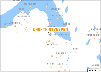
Chak Thirty-seven (Sind, Pakistan)Chak Thirty-seven is a town in the Sind region of Pakistan. An overview map of the region around Chak Thirty-seven is displayed below.
regional and 3d topo map of Chak Thirty-seven, Pakistan ::
Chak Thirty-seven airports ::
The nearest airport is WNS - Nawabshah, located 54.5 km west of Chak Thirty-seven.
Other airports nearby include MJD - Moenjodaro (140.1 km north west), SKZ - Sukkur (159.7 km north), BDN - Talhar (160.3 km south), JSA - Jaisalmer (203.9 km east), Nearby towns ::
Chak Forty-one (1.9km south) //
Chak Thirty-eight (1.9km south east) //
Jakhrāo (2.2km north) //
Chak Forty (2.6km south) //
Jakhrao (2.6km south west) //
Chak Thirty-nine (3.7km east) //
Chak Fifty-six (4.4km south) //
Dholo (5.1km north) //
Māhno Khān (5.7km east) //
Tugācho (6.3km north east) //
Mālīr Khān (6.9km north) //
Chak Fifty-seven (7.4km south) //
Rahīm jo Goth (8.0km south) //
Shamanās (8.4km south east) //
Chak Sixteen (9.4km north west) //
[all distances 'as the bird flies' and approximate] 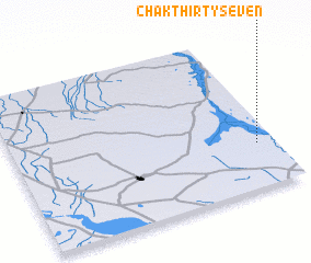 Places with similar names to Chak Thirty-seven, Pakistan ::
// Chak Thirty-seven (PK)
// Chak Thirty-seven (PK)
// Chak Thirty-seven (PK)
// Chak Thirty-seven (PK)
// Chak Thirty-seven (PK)
// Chak Thirty-seven (PK)
// Chak Thirty-seven (PK)
// Chak Thirty-seven (PK)
// Chak Thirty-seven (PK)
Disclaimer :: Information on this page comes without warranty of any kind |
||
|
Where is Chak Thirty-seven? Elevation and coordinates ::
Latitude (lat): 26°17'10"N Longitude (lon): 68°55'50"E
Elevation (approx.): 26m (map arrows pan, magnifying glasses zoom) |
||
|
Visiting Chak Thirty-seven? Hotel/Accommodation ::
Book a hotel in Chak Thirty-seven Travel Guide ::
Buy a travel guide for Pakistan rental cars ::
car rental offers GPS waypoint ::
download a GPX waypoint (PoI) of Chak Thirty-seven for your GPS receiver
|
||