|
search place name
|
||
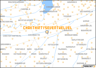
Chak Thirty-seven-Twelve L (Punjab, Pakistan)Chak Thirty-seven-Twelve L is a town in the Punjab region of Pakistan. An overview map of the region around Chak Thirty-seven-Twelve L is displayed below.
regional and 3d topo map of Chak Thirty-seven-Twelve L, Pakistan ::
Chak Thirty-seven-Twelve L airports ::
The nearest airport is LYP - Faisalabad Intl, located 93.7 km north of Chak Thirty-seven-Twelve L.
Other airports nearby include MUX - Multan Intl (133.2 km west), LHE - Lahore Allama Iqbal Intl (191.5 km north east), Nearby towns ::
Kīmiānwāla (1.0km north east) //
Chak Thirty-six-Twelve L (1.5km south) //
Chak Thirty-eight-Twelve L (1.6km south west) //
Chak One Hundred Ten-Seven AR (2.5km north) //
Saidānwāla (3.2km north east) //
Chak Ten-Eleven L (3.3km east) //
Chariībon ki Basti (3.5km south west) //
Dogarpur (3.9km south east) //
Chak Thirty-nine-Twelve L (3.7km south west) //
Docharkha Kanhaiya Lāl (4.2km north) //
Chak Thirty-five-Twelve (4.5km south) //
Chak Eight-Eleven L (4.1km south east) //
Dād Fattiāna (4.1km north east) //
Bhattinagar (4.4km north east) //
Kot Hazāra (4.5km north east) //
Chak One Hundred Eleven-Seven AR (4.3km west) //
Chak Seven-Eleven L (4.4km east) //
Thatta Sabāne (4.9km north west) //
Jhangi Siāl (5.0km north west) //
Bhattiānwāla (5.1km north east) //
Chīchāwatni (4.8km west) //
Kot Hazāra (5.5km north east) //
Kot Gūjrān (5.6km south) //
Chauki Chaupat Rāi (6.0km north) //
Chak Forty-one-Twelve L (5.9km south west) //
Faridwāli Jhalār (6.1km north west) //
Islāmābād (6.1km south east) //
Chisht (7.0km north) //
Chandol (7.1km south) //
[all distances 'as the bird flies' and approximate] 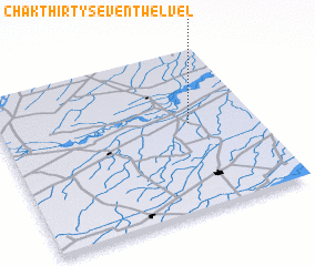 Places with similar names to Chak Thirty-seven-Twelve L, Pakistan :: Disclaimer :: Information on this page comes without warranty of any kind |
||
|
Where is Chak Thirty-seven-Twelve L? Elevation and coordinates ::
Latitude (lat): 30°32'50"N Longitude (lon): 72°44'50"E
Elevation (approx.): 163m (map arrows pan, magnifying glasses zoom) |
||
|
Visiting Chak Thirty-seven-Twelve L? Hotel/Accommodation ::
Book a hotel in Chak Thirty-seven-Twelve L Travel Guide ::
Buy a travel guide for Pakistan rental cars ::
car rental offers GPS waypoint ::
download a GPX waypoint (PoI) of Chak Thirty-seven-Twelve L for your GPS receiver
|
||