|
search place name
|
||
Chak Twenty-seven-Eight L (Punjab, Pakistan)Chak Twenty-seven-Eight L is a town in the Punjab region of Pakistan. An overview map of the region around Chak Twenty-seven-Eight L is displayed below.
regional and 3d topo map of Chak Twenty-seven-Eight L, Pakistan ::

Chak Twenty-seven-Eight L airports ::
The nearest airport is MUX - Multan Intl, located 97.2 km west of Chak Twenty-seven-Eight L.
Other airports nearby include LYP - Faisalabad Intl (158.1 km north), LHE - Lahore Allama Iqbal Intl (252.5 km north east), Nearby towns ::
Jallāwāla (0.9km south) //
Bhaini Karam Gundiāl (2.0km south east) //
Chak Twenty-seven (1.9km east) //
Laktānwāla (2.2km south west) //
Lot Number One (2.3km north west) //
Kashmīr (2.8km south) //
ChakTwenty-three (2.7km north east) //
Chak Thirty-seven-Eight L (2.9km south west) //
Lot Number Two (2.8km west) //
Seohanwāla (3.8km north) //
Chak Seven-Eight L (4.5km north) //
Daulatāna (4.0km east) //
Chak Nine-Eight L (4.6km north west) //
Ahmad Yār Daulatāna (4.4km south east) //
Chak Five-Eight L (5.0km north) //
Chak Forty-nine-Eight L (4.8km south west) //
Chak Twenty-one (5.3km north east) //
Pīr Bakhshwāla (5.4km south east) //
Kusamsar (5.6km north east) //
Chak Sixteen-Four R (6.2km north) //
Chak Twenty-five-Eight L (6.0km north east) //
Chak Forty-seven-Eight L (5.6km west) //
Vihāri (5.6km west) //
Chak Eighteen-Four R (6.8km north west) //
Burāli Kalālānwāli (6.9km north) //
Chak Forty-seven-Eight L (6.3km west) //
Qādirwāh (7.3km south) //
Chak Five Hundred Seventy-seven-Seven L (6.5km east) //
Sandānwāla (7.4km north) //
[all distances 'as the bird flies' and approximate] 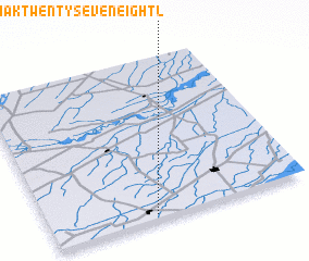 Places with similar names to Chak Twenty-seven-Eight L, Pakistan :: Disclaimer :: Information on this page comes without warranty of any kind |
||
|
Where is Chak Twenty-seven-Eight L? Elevation and coordinates ::
Latitude (lat): 30°1'55"N Longitude (lon): 72°24'30"E
Elevation (approx.): 139m (map arrows pan, magnifying glasses zoom) |
||
|
Visiting Chak Twenty-seven-Eight L? Hotel/Accommodation ::
Book a hotel in Chak Twenty-seven-Eight L Travel Guide ::
Buy a travel guide for Pakistan rental cars ::
car rental offers GPS waypoint ::
download a GPX waypoint (PoI) of Chak Twenty-seven-Eight L for your GPS receiver
|
||