|
search place name
|
||
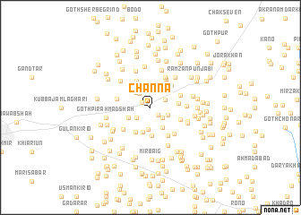
Channa (Sind, Pakistan)Channa is a town in the Sind region of Pakistan. An overview map of the region around Channa is displayed below.
regional and 3d topo map of Channa, Pakistan ::
Channa airports ::
The nearest airport is WNS - Nawabshah, located 18.4 km west of Channa.
Other airports nearby include MJD - Moenjodaro (125.7 km north), BDN - Talhar (160.2 km south), SKZ - Sukkur (162.8 km north), KHI - Karachi Jinnah Intl (206.5 km south west), Nearby towns ::
Goth Major Yār Muhammad (1.1km north west) //
Goth Nabi Bakhsh Brāhui (1.2km south east) //
Goth Sajjād Hussain Shāh (1.9km south east) //
Goth Mirza (1.9km north east) //
Hāji Muhammad Bakhsh (2.0km south west) //
Goth Mīr Faiz Ali (2.1km north west) //
Goth Gul Beg Marri (2.2km north west) //
Ali Nawāz (2.1km south east) //
Manghar Mal (2.5km north west) //
Tāj Muhammad Pathān (2.8km south) //
Nūr Muhammad (2.8km south east) //
Goth Gul Muhammad Bhutto (2.8km south west) //
Hāji Firdaus Pathān (3.2km south) //
Muhammad Afzal Pathān (3.6km south) //
Mirza Manzūr (3.2km east) //
Hāji Nazīr Muhammad (3.5km south west) //
Goth Wādhu Mal (3.6km north west) //
Ismāīl Hāji Mūsa (3.6km north east) //
Hāji Muhammad Dharo (3.7km south east) //
Nārānpur (3.7km north east) //
Motal Shāh (4.0km north east) //
Sūka (4.1km north east) //
Hāji Ghulām Haider (4.0km south east) //
Goth Hāji Miān Hussain (3.9km west) //
Ganhwar Khān Gupehāni (4.2km south east) //
Hāji Abdullāh (4.1km south west) //
Qāzi Goth (4.0km east) //
Hāji Amīr Khān (4.6km north east) //
Goth Khān Muhammad Brāhui (4.8km north) //
[all distances 'as the bird flies' and approximate] 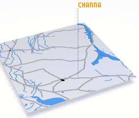 Places with similar names to Channa, Pakistan ::
Disclaimer :: Information on this page comes without warranty of any kind |
||
|
Where is Channa? Elevation and coordinates ::
Latitude (lat): 26°16'0"N Longitude (lon): 68°34'0"E
Elevation (approx.): 29m (map arrows pan, magnifying glasses zoom) |
||
|
Visiting Channa? Hotel/Accommodation ::
Book a hotel in Channa Travel Guide ::
Buy a travel guide for Pakistan rental cars ::
car rental offers GPS waypoint ::
download a GPX waypoint (PoI) of Channa for your GPS receiver
|
||