|
search place name
|
||
Chinār (Federally Administered Tribal Areas, Pakistan)Chinār is a town in the Federally Administered Tribal Areas region of Pakistan. An overview map of the region around Chinār is displayed below.
regional and 3d topo map of Chinār, Pakistan ::

Chinār airports ::
The nearest airport is JAA - Jalalabad, located 67.9 km north of Chinār.
Other airports nearby include PEW - Peshawar Intl (108.5 km east), KBL - Kabul Intl (136.1 km north west), SDT - Saidu Sharif (214.9 km north east), Nearby towns ::
Khujali Mela (0.4km north west) //
Kharkai (1.0km east) //
Gharbina (1.2km north) //
Khai Tangi (1.2km north west) //
Shudo Paila (1.3km north west) //
Zamdo Mela (2.4km west) //
Lokhai (2.7km north east) //
Gaodara (2.7km west) //
Gaodar Kili (3.1km south east) //
Landai Pakha (4.1km north) //
Samana (4.1km north) //
Sarwanai (3.8km north east) //
Cherai (4.4km north) //
Tāpu (4.3km north east) //
Gwaza (4.6km north) //
Aīpai (4.1km north east) //
Sha (4.9km north) //
Aud (4.9km north west) //
Shakardarra (4.4km west) //
Girdaghunai (5.3km north) //
Baza (5.4km north) //
Tita Wela (4.7km east) //
Ismāīl Khel (5.6km north) //
Shinkai (5.7km north) //
Girdai (5.7km north) //
Mela (6.0km north) //
Hāji Khānchīna (6.1km north) //
Zer Tangi (6.3km north) //
Khazīna (6.3km north west) //
[all distances 'as the bird flies' and approximate] 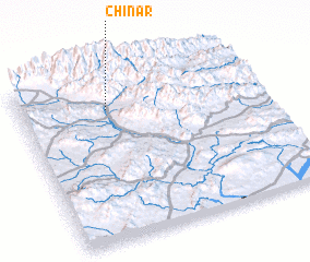 Places with similar names to Chinār, Pakistan ::
Disclaimer :: Information on this page comes without warranty of any kind |
||
|
Where is Chinār? Elevation and coordinates ::
Latitude (lat): 33°47'54"N Longitude (lon): 70°21'53"E
Elevation (approx.): 2011m (map arrows pan, magnifying glasses zoom) |
||
|
Visiting Chinār? Hotel/Accommodation ::
Book a hotel in Chinār Travel Guide ::
Buy a travel guide for Pakistan rental cars ::
car rental offers GPS waypoint ::
download a GPX waypoint (PoI) of Chinār for your GPS receiver
|
||