|
search place name
|
||
Chirāgh Shāh Anb (Punjab, Pakistan)Chirāgh Shāh Anb is a town in the Punjab region of Pakistan. An overview map of the region around Chirāgh Shāh Anb is displayed below.
regional and 3d topo map of Chirāgh Shāh Anb, Pakistan ::

Chirāgh Shāh Anb airports ::
The nearest airport is LYP - Faisalabad Intl, located 99.5 km north east of Chirāgh Shāh Anb.
Other airports nearby include MUX - Multan Intl (108.4 km south west), LHE - Lahore Allama Iqbal Intl (212.6 km north east), Nearby towns ::
Bab (1.9km north) //
Kikri Sher Shāh (1.6km east) //
Dhedi (1.6km west) //
Dargāhipur (2.4km north west) //
Chak Seven Hundred Forty-eight (3.2km north west) //
Mauza Hashi (3.2km south east) //
Babchak Kheruwāla (3.2km north east) //
Chak Seven Hundred Forty-six (3.5km north east) //
Dulluān (3.7km south) //
Chak Seven Hundred Forty-seven (3.9km north) //
Chak Arbāb (3.8km south east) //
Shahrewāla (3.8km north west) //
Burji (4.1km south east) //
Dahān Jangal (4.2km west) //
Mauza Mahe Kāthia (4.5km north east) //
Chak One Hundred Twenty-two-Seven ER (5.0km south east) //
Chak One Hundred Twenty-three-Seven ER (5.2km south) //
Nazarābād (4.8km north west) //
Bunga (5.1km south west) //
Chak Seven Hundred Forty-nine (5.3km north west) //
Chak Seven Hundred Forty-three (5.3km north east) //
Siālān (5.8km north) //
Chak One Hundred Twenty-five-Seven ER (5.9km south) //
Chak Seven Hundred Forty-four (6.0km north) //
Chak One Hundred Twenty-one-Seven ER (5.9km south east) //
Chak One Hundred Twenty-four-Seven ER (6.5km south) //
Bhopri Āya Khera (5.9km south west) //
Najābat ke Kāthia (5.9km north east) //
Wāghi (6.4km north east) //
[all distances 'as the bird flies' and approximate] 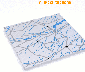 Places with similar names to Chirāgh Shāh Anb, Pakistan :: Disclaimer :: Information on this page comes without warranty of any kind |
||
|
Where is Chirāgh Shāh Anb? Elevation and coordinates ::
Latitude (lat): 30°36'0"N Longitude (lon): 72°27'0"E
Elevation (approx.): 148m (map arrows pan, magnifying glasses zoom) |
||
|
Visiting Chirāgh Shāh Anb? Hotel/Accommodation ::
Book a hotel in Chirāgh Shāh Anb Travel Guide ::
Buy a travel guide for Pakistan rental cars ::
car rental offers GPS waypoint ::
download a GPX waypoint (PoI) of Chirāgh Shāh Anb for your GPS receiver
|
||