|
search place name
|
||
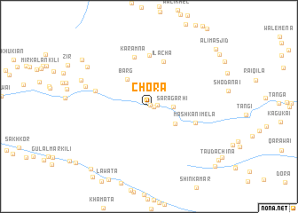
Chora (Federally Administered Tribal Areas, Pakistan)Chora is a town in the Federally Administered Tribal Areas region of Pakistan. An overview map of the region around Chora is displayed below.
regional and 3d topo map of Chora, Pakistan ::
Chora airports ::
The nearest airport is PEW - Peshawar Intl, located 30.8 km east of Chora.
Other airports nearby include JAA - Jalalabad (79.3 km north west), SDT - Saidu Sharif (142.8 km north east), ISB - Islamabad Chaklala (181.6 km east), KBL - Kabul Intl (193.3 km west), Nearby towns ::
Tindai Kili (0.2km north east) //
Latīf Kili (0.5km east) //
Shangeri Khula (0.9km east) //
Sara Garhi (2.5km east) //
Ghurāsgo Mela (3.6km south east) //
Barg (4.1km north west) //
Ilācha (5.8km north) //
Mashkani Mela (5.3km south east) //
Karamna (6.4km north) //
Dargai (6.5km north) //
Maimīnai Qabr (6.0km west) //
Sara Singer (7.1km west) //
Walai (7.9km north west) //
Wucha Walāi (8.2km north west) //
Landikhāna (9.1km north west) //
Galli Khel (9.9km south west) //
Tauda Chīna (9.9km south east) //
Said Ali Mela (9.8km north east) //
Ali Masjid (10.0km north east) //
Maira Bāz Garhi (10.2km south east) //
Ghundai (10.6km south west) //
[all distances 'as the bird flies' and approximate] 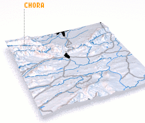 Places with similar names to Chora, Pakistan ::
Disclaimer :: Information on this page comes without warranty of any kind |
||
|
Where is Chora? Elevation and coordinates ::
Latitude (lat): 33°58'0"N Longitude (lon): 71°11'0"E
Elevation (approx.): 941m (map arrows pan, magnifying glasses zoom) |
||
|
Visiting Chora? Hotel/Accommodation ::
Book a hotel in Chora Travel Guide ::
Buy a travel guide for Pakistan rental cars ::
car rental offers GPS waypoint ::
download a GPX waypoint (PoI) of Chora for your GPS receiver
|
||