|
search place name
|
||
Dag (Federally Administered Tribal Areas, Pakistan)Dag is a town in the Federally Administered Tribal Areas region of Pakistan. An overview map of the region around Dag is displayed below.
regional and 3d topo map of Dag, Pakistan ::

Dag airports ::
The nearest airport is PZH - Zhob, located 70.2 km south west of Dag.
Other airports nearby include MUX - Multan Intl (204.0 km south east), Nearby towns ::
Mullā Oba (1.1km east) //
Karam (2.4km west) //
Bain (2.8km south east) //
Vera Shapie (3.3km south east) //
Girdghun (3.8km south west) //
Bar Chitta (3.7km west) //
Tsode (4.3km north west) //
Zar Shahr (5.1km north) //
Zar Sar (5.1km north) //
Pīr Ghundi (5.5km north) //
Geza Rāaza (5.2km north west) //
Maidān (5.0km west) //
Karghal (5.2km north west) //
Drazinda (6.1km north) //
Darwāzai (5.7km west) //
Spīn Tangai (6.6km south) //
Landai Stānadār (6.6km north) //
Landai (6.8km south) //
Shaikh Mela (6.7km south east) //
Khesāri (6.1km west) //
Ilyās Khazāi (6.2km west) //
Landai (7.3km north) //
Landai Mutawar (7.5km north west) //
Nishfazāi (6.9km west) //
Chīna (8.0km south) //
Rāghāsar (7.4km south west) //
Bāspa (7.3km north west) //
Sargai (8.6km north) //
Sarob (8.4km south west) //
[all distances 'as the bird flies' and approximate] 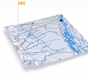 Places with similar names to Dag, Pakistan ::
Disclaimer :: Information on this page comes without warranty of any kind |
||
|
Where is Dag? Elevation and coordinates ::
Latitude (lat): 31°39'34"N Longitude (lon): 70°6'49"E
Elevation (approx.): 582m (map arrows pan, magnifying glasses zoom) |
||
|
Visiting Dag? Hotel/Accommodation ::
Book a hotel in Dag Travel Guide ::
Buy a travel guide for Pakistan rental cars ::
car rental offers GPS waypoint ::
download a GPX waypoint (PoI) of Dag for your GPS receiver
|
||