|
search place name
|
||
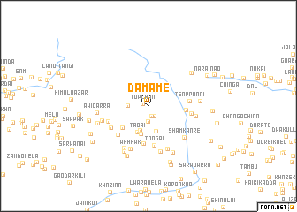
Damame (Federally Administered Tribal Areas, Pakistan)Damame is a town in the Federally Administered Tribal Areas region of Pakistan. An overview map of the region around Damame is displayed below.
regional and 3d topo map of Damame, Pakistan ::
Damame airports ::
The nearest airport is JAA - Jalalabad, located 58.8 km north of Damame.
Other airports nearby include PEW - Peshawar Intl (96.4 km east), KBL - Kabul Intl (140.2 km north west), SDT - Saidu Sharif (201.4 km north east), Nearby towns ::
Tupchan (0.7km north west) //
Dilbeg Sawe (1.3km south) //
Star Pala (1.4km south east) //
Timār Khand (1.9km south) //
Kuni Kānrai (2.2km west) //
Makhmanda (3.2km south) //
Pore Mela (3.2km south) //
Tabai (3.5km south) //
Tarmira (3.6km south) //
Pas Melā (3.9km south west) //
Takhte (4.8km south) //
Gharībai (4.0km east) //
Tongai (5.0km south) //
Tsapparai (4.4km east) //
Takhtak (4.8km south west) //
Narmai (4.6km south west) //
Langar (4.8km south west) //
Gandao (4.6km east) //
Akhkak (5.7km south) //
Taghūna (5.7km south) //
Taghūna (5.8km south) //
Sham Kānre (5.5km south east) //
Baze (5.9km south west) //
Tājo (5.2km east) //
Kharki (5.2km west) //
Dunga (6.3km south west) //
Kandu (5.5km east) //
Awidarra (5.5km west) //
Mānre Chīna (6.4km south east) //
[all distances 'as the bird flies' and approximate] 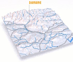 Places with similar names to Damame, Pakistan ::
Disclaimer :: Information on this page comes without warranty of any kind |
||
|
Where is Damame? Elevation and coordinates ::
Latitude (lat): 33°52'12"N Longitude (lon): 70°28'59"E
Elevation (approx.): 2322m (map arrows pan, magnifying glasses zoom) |
||
|
Visiting Damame? Hotel/Accommodation ::
Book a hotel in Damame Travel Guide ::
Buy a travel guide for Pakistan rental cars ::
car rental offers GPS waypoint ::
download a GPX waypoint (PoI) of Damame for your GPS receiver
|
||