|
search place name
|
||
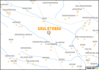
Daulatābād (North-West Frontier, Pakistan)Daulatābād is a town in the North-West Frontier region of Pakistan. An overview map of the region around Daulatābād is displayed below.
regional and 3d topo map of Daulatābād, Pakistan ::
Daulatābād airports ::
The nearest airport is PZH - Zhob, located 148.9 km south west of Daulatābād.
Other airports nearby include MUX - Multan Intl (213.4 km south), PEW - Peshawar Intl (225.0 km north), Nearby towns ::
Rodi Khel (3.1km north east) //
Ittefāqābād (4.5km south) //
Wānda Khajjiwāla (4.4km south west) //
Ali Wānda (5.1km south east) //
Machhīwāla Bānda (5.8km south) //
Gandāpur Yādgār (5.7km north west) //
Yārik (5.7km north) //
Umar Khān Wānda (7.9km north east) //
Kech (8.7km south east) //
Nūrokai Wānda (9.0km north east) //
Wānda Paihl (9.5km south west) //
Muqim Shāh (10.1km south east) //
[all distances 'as the bird flies' and approximate] 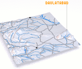 Places with similar names to Daulatābād, Pakistan ::
// Dowlatābād (IR)
// Dowlatābād (IR)
// Dowlatābād (IR)
// Dowlatābād (IR)
// Dowlatābād (IR)
// Dowlatābād (IR)
// Dowlatābād (IR)
// Dowlatābād (IR)
// Dowlatābād (IR)
// Dowlatābād (IR)
Disclaimer :: Information on this page comes without warranty of any kind |
||
|
Where is Daulatābād? Elevation and coordinates ::
Latitude (lat): 32°3'16"N Longitude (lon): 70°48'25"E
Elevation (approx.): 198m (map arrows pan, magnifying glasses zoom) |
||
|
Visiting Daulatābād? Hotel/Accommodation ::
Book a hotel in Daulatābād Travel Guide ::
Buy a travel guide for Pakistan rental cars ::
car rental offers GPS waypoint ::
download a GPX waypoint (PoI) of Daulatābād for your GPS receiver
|
||