|
search place name
|
||
Derān Kili (North-West Frontier, Pakistan)Derān Kili is a town in the North-West Frontier region of Pakistan. An overview map of the region around Derān Kili is displayed below.
regional and 3d topo map of Derān Kili, Pakistan ::

Derān Kili airports ::
The nearest airport is SDT - Saidu Sharif, located 19.1 km east of Derān Kili.
Other airports nearby include PEW - Peshawar Intl (106.7 km south west), MFG - Muzaffarabad (135.3 km east), JAA - Jalalabad (157.4 km west), ISB - Islamabad Chaklala (158.2 km south east), Nearby towns ::
Aspanr Kili (0.5km east) //
Kashmīr Kili (0.5km east) //
Sampai (1.1km north) //
Shāh Kuz (1.2km south west) //
Derai Miāngān Kili (1.3km east) //
Joro Pai (1.8km south east) //
Amīr Pai (1.9km south east) //
Hamza Bānda (1.9km north west) //
Derakai Kili (1.9km north east) //
Kumbhar (2.6km north) //
Khwās Kili (2.7km south) //
Manti Borai (2.3km south east) //
Zor Mianlāwar (2.8km north east) //
Dūo Kili (2.7km north east) //
Awi Shāh Kili (2.6km west) //
Kuz Aspanr (2.7km south west) //
Nawagai Bānda (2.9km south east) //
Raghai Kili (3.2km north) //
Miānda (2.8km east) //
Karmal Kili (2.8km west) //
Derai Kaskai (3.6km north) //
Bābūzai (3.7km north) //
Awi Shāh (3.1km west) //
Jalātai Bānda (3.4km north west) //
Loe Shorshing (3.8km north west) //
Bambolai Kili (4.0km south) //
Ahingara Bāba Ziārat (3.6km north east) //
Barkhāmia Jāwar (4.0km north east) //
But Qila (3.8km west) //
[all distances 'as the bird flies' and approximate] 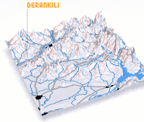 Places with similar names to Derān Kili, Pakistan ::
// Terengul' (RU)
// Terenkul' (RU)
// Terenkul' (RU)
// Terenkul' (RU)
// Triangle (US)
// Tranquilla (PA)
// Tranquilla (PA)
// Tranquilla (PA)
// Triángulo (CU)
// Turnagöl (TR)
Disclaimer :: Information on this page comes without warranty of any kind |
||
|
Where is Derān Kili? Elevation and coordinates ::
Latitude (lat): 34°48'5"N Longitude (lon): 72°8'40"E
Elevation (approx.): 1243m (map arrows pan, magnifying glasses zoom) |
||
|
Visiting Derān Kili? Hotel/Accommodation ::
Book a hotel in Derān Kili Travel Guide ::
Buy a travel guide for Pakistan rental cars ::
car rental offers GPS waypoint ::
download a GPX waypoint (PoI) of Derān Kili for your GPS receiver
|
||