|
search place name
|
||
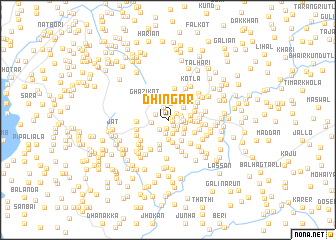
Dhingar (North-West Frontier, Pakistan)Dhingar is a town in the North-West Frontier region of Pakistan. An overview map of the region around Dhingar is displayed below.
regional and 3d topo map of Dhingar, Pakistan ::
Dhingar airports ::
The nearest airport is MFG - Muzaffarabad, located 45.4 km east of Dhingar.
Other airports nearby include ISB - Islamabad Chaklala (80.3 km south), SDT - Saidu Sharif (80.5 km north west), RAZ - Rawala Kot Rawalakot (90.3 km south east), PEW - Peshawar Intl (143.5 km west), Nearby towns ::
Sum (0.4km east) //
Seri Ahal (0.5km north east) //
Rahīm Ali (0.8km south east) //
Shilāiān (0.9km south) //
Akār (1.1km north east) //
Khiliāla (1.1km south east) //
Pūna (1.3km south east) //
Hariāla (1.3km south west) //
Devi (1.2km east) //
Khoriān (1.4km north) //
Kandar (1.3km north west) //
Rari (1.3km east) //
Harīgarān (1.6km south) //
Kangar (1.3km east) //
Tarehri (1.6km south) //
Seri Phūlān (1.4km east) //
Madsiryān (1.9km north) //
Batangi (1.6km west) //
Budhka (1.7km east) //
Timar Bānda (1.8km south east) //
Deoriān (2.2km south) //
Razzāq (2.0km north east) //
Bāndiān (2.2km north west) //
Bāi Bānda (2.1km south east) //
Hāso (2.1km north east) //
Sāri Bāndi (2.3km north) //
Maira (2.0km east) //
Phalkot (2.5km south) //
Manewāl (2.1km east) //
[all distances 'as the bird flies' and approximate] 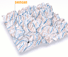 Places with similar names to Dhingar, Pakistan ::
Disclaimer :: Information on this page comes without warranty of any kind |
||
|
Where is Dhingar? Elevation and coordinates ::
Latitude (lat): 34°20'15"N Longitude (lon): 73°0'55"E
Elevation (approx.): 1115m (map arrows pan, magnifying glasses zoom) |
||
|
Visiting Dhingar? Hotel/Accommodation ::
Book a hotel in Dhingar Travel Guide ::
Buy a travel guide for Pakistan rental cars ::
car rental offers GPS waypoint ::
download a GPX waypoint (PoI) of Dhingar for your GPS receiver
|
||