|
search place name
|
||
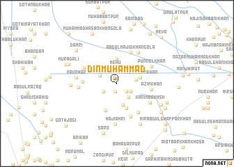
Dīn Muhammad (Sind, Pakistan)Dīn Muhammad is a town in the Sind region of Pakistan. An overview map of the region around Dīn Muhammad is displayed below.
regional and 3d topo map of Dīn Muhammad, Pakistan ::
Dīn Muhammad airports ::
The nearest airport is SUL - Sui, located 64.9 km north east of Dīn Muhammad.
Other airports nearby include SKZ - Sukkur (79.4 km south), MJD - Moenjodaro (126.4 km south), RYK - Rahim Yar Khan Sheikh Zayed (167.6 km east), UET - Quetta (258.3 km north west), Nearby towns ::
Jatta (1.3km south) //
Dalel Khān Khoso (1.8km south east) //
Pāndi Koli (2.3km south west) //
Mehu (2.5km north) //
Muhammad Panāh (2.3km south east) //
Sarfrāz (2.7km south east) //
Muhānrān (2.7km north west) //
Abdul Majid Khosra (2.8km east) //
Muhammad Salīm (3.5km south) //
Hāji Hazār Khān (3.4km east) //
Arbāb Khān (4.0km north) //
Durri Khān (4.2km south) //
Jāni Nau Khosa (4.6km south) //
Abdul Majid Khān Gola (5.3km north) //
Misri Bhangar (4.9km west) //
Azim Khān (5.0km east) //
Jān Muhammad (5.6km south) //
Dhani Bakhsh Banglāni (5.5km south east) //
Darya Khān (5.2km north west) //
Jumma Khān (5.8km north east) //
Karīm Bakhsh (5.6km south east) //
Ghulam Hussain Wāhga (5.5km west) //
Punnel Khān (5.6km north east) //
Hajiāhri (6.5km south) //
Nāunhar (5.8km west) //
Khair Muhammad Wāhga (6.5km west) //
Chutta Taunwāri (7.3km south east) //
Mahmūd Khān Gola (7.1km south east) //
Murād Ali (7.5km north west) //
[all distances 'as the bird flies' and approximate]  Places with similar names to Dīn Muhammad, Pakistan ::
// Dīn Moḩammad (IR)
// Dīn Moḩammadī (IR)
// Dīn Muhammad (PK)
// Dīn Muhammad (PK)
// Dīn Muhammad (PK)
// Dīn Muhammad (PK)
// Dīn Muhammad (PK)
// Dīn Muhammad (PK)
// Dīn Muhammad (PK)
// Din Muhammad (PK)
Disclaimer :: Information on this page comes without warranty of any kind |
||
|
Where is Dīn Muhammad? Elevation and coordinates ::
Latitude (lat): 28°24'40"N Longitude (lon): 68°34'10"E
Elevation (approx.): 55m (map arrows pan, magnifying glasses zoom) |
||
|
Visiting Dīn Muhammad? Hotel/Accommodation ::
Book a hotel in Dīn Muhammad Travel Guide ::
Buy a travel guide for Pakistan rental cars ::
car rental offers GPS waypoint ::
download a GPX waypoint (PoI) of Dīn Muhammad for your GPS receiver
|
||