|
search place name
|
||
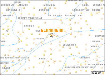
Elamnagar (Punjab, Pakistan)Elamnagar is a town in the Punjab region of Pakistan. An overview map of the region around Elamnagar is displayed below.
regional and 3d topo map of Elamnagar, Pakistan ::
Elamnagar airports ::
The nearest airport is LYP - Faisalabad Intl, located 119.9 km north of Elamnagar.
Other airports nearby include MUX - Multan Intl (127.8 km west), LHE - Lahore Allama Iqbal Intl (208.4 km north east), Nearby towns ::
Dera Chaman Lāl (1.1km north east) //
Nathūwāla (1.5km north west) //
Chak One Hundred EB (1.5km north east) //
Chak One Hundred Six-Two BR (1.6km west) //
Chak Four Hundred Five (2.2km south) //
Chak One Hundred Sixty-nine A Nine L (2.6km north) //
Chak Four Hundred Three (2.9km south east) //
Chak One Hundred Four-Two BR (3.0km north west) //
Chak Four Hundred Eleven EB (3.7km south east) //
Chak One Hundred Sixty-five Nine L (3.9km north east) //
Chak Four Hundred Nine EB (4.1km south) //
Chak One Hundred Eight EB (3.9km south west) //
Rājewāla (3.8km south west) //
Chak Four Hundred Eleven EB (4.4km south) //
Chak Four Hundred One (4.2km east) //
Kalāli (4.2km west) //
Chak Ninety-eight EB (4.4km north east) //
Chak Four Hundred Thirteen (4.7km south east) //
Chak Four Hundred Thirteen EB (5.2km south east) //
Chak Four Hundred Nineteen (5.3km south west) //
Chak Four Hundred Seventeen EB (5.9km south) //
Chak One Hundred Sixty-nine-Nine L (5.8km north west) //
Islāmābād (5.7km north west) //
Chak One Hundred Sixty-four A Nine L (6.0km north east) //
Chak One Hundred Twelve EB (5.6km south west) //
Chak One Hundred Fourteen EB (5.6km west) //
Shaikh Fāzil (5.7km east) //
Hargobindpur (6.8km north) //
Kartārnagar (6.8km north) //
[all distances 'as the bird flies' and approximate]  Places with similar names to Elamnagar, Pakistan ::
// El Mangar (MX)
// El Moungar (MA)
Disclaimer :: Information on this page comes without warranty of any kind |
||
|
Where is Elamnagar? Elevation and coordinates ::
Latitude (lat): 30°18'20"N Longitude (lon): 72°44'30"E
Elevation (approx.): 149m (map arrows pan, magnifying glasses zoom) |
||
|
Visiting Elamnagar? Hotel/Accommodation ::
Book a hotel in Elamnagar Travel Guide ::
Buy a travel guide for Pakistan rental cars ::
car rental offers GPS waypoint ::
download a GPX waypoint (PoI) of Elamnagar for your GPS receiver
|
||