|
search place name
|
||
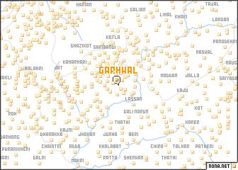
Garhwāl (North-West Frontier, Pakistan)Garhwāl is a town in the North-West Frontier region of Pakistan. An overview map of the region around Garhwāl is displayed below.
regional and 3d topo map of Garhwāl, Pakistan ::
Garhwāl airports ::
The nearest airport is MFG - Muzaffarabad, located 42.7 km east of Garhwāl.
Other airports nearby include ISB - Islamabad Chaklala (77.2 km south), SDT - Saidu Sharif (84.6 km north west), RAZ - Rawala Kot Rawalakot (86.3 km south east), PEW - Peshawar Intl (145.5 km west), Nearby towns ::
Ghori (0.7km south) //
Sarni (0.9km north east) //
Phuldhār (0.8km west) //
Shāhkot (1.1km south east) //
Baila (1.4km south east) //
Paurān Maira (1.5km north east) //
Darra (1.6km south) //
Bāndi (1.6km north) //
Gharāne (1.6km south west) //
Khāliq Maira (1.9km north) //
Tamnāla (1.7km west) //
Kihamali (1.7km west) //
Thandi Baihni (1.9km north east) //
Bāi Bānda (2.0km north west) //
Pūtkhola (1.9km west) //
Khidar (2.2km north east) //
Khel (2.1km east) //
Phulra (2.5km north) //
Khanda Khūh (2.3km south east) //
Timar Bānda (2.4km north west) //
Tilhāla (2.6km north) //
Gojrāh (2.2km east) //
Tarappi (2.3km south east) //
Maira (2.8km north) //
Kokrakkāh (2.8km north) //
Maira (2.8km north east) //
Budhka (2.9km north west) //
Phalkot (2.5km west) //
Maira (3.0km north) //
[all distances 'as the bird flies' and approximate] 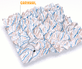 Places with similar names to Garhwāl, Pakistan ::
Disclaimer :: Information on this page comes without warranty of any kind |
||
|
Where is Garhwāl? Elevation and coordinates ::
Latitude (lat): 34°18'40"N Longitude (lon): 73°2'45"E
Elevation (approx.): 921m (map arrows pan, magnifying glasses zoom) |
||
|
Visiting Garhwāl? Hotel/Accommodation ::
Book a hotel in Garhwāl Travel Guide ::
Buy a travel guide for Pakistan rental cars ::
car rental offers GPS waypoint ::
download a GPX waypoint (PoI) of Garhwāl for your GPS receiver
|
||