|
search place name
|
||
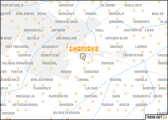
Ghaniāke (Punjab, Pakistan)Ghaniāke is a town in the Punjab region of Pakistan. An overview map of the region around Ghaniāke is displayed below.
regional and 3d topo map of Ghaniāke, Pakistan ::
Ghaniāke airports ::
The nearest airport is LYP - Faisalabad Intl, located 38.2 km north east of Ghaniāke.
Other airports nearby include MUX - Multan Intl (160.4 km south west), LHE - Lahore Allama Iqbal Intl (166.7 km east), Nearby towns ::
Santokhsar (0.9km south east) //
Widāla (1.6km east) //
Santokhsar (1.9km south) //
Shalamār (2.4km north east) //
Zira Nawān (2.4km north west) //
Didārpur (3.7km north) //
Bujianwāla (3.2km west) //
Chawinda (4.0km south east) //
Jite (4.0km south west) //
Kacha Gojra (4.9km north west) //
Gojra (4.9km north west) //
Padhri (4.9km south west) //
Chahal (5.6km south) //
Gil Janūbi (5.6km north) //
Kot Brandreth (5.1km west) //
Rām Roni (5.1km east) //
Bambai Nawān (6.6km north) //
Kohli (6.4km north east) //
Khatra (6.3km east) //
Robertsar (6.3km west) //
Sakhira (6.6km east) //
Lālpur (7.6km south) //
Goughpur (6.6km west) //
Pairewāl (6.6km west) //
Gagu Mahal (7.6km south) //
Jafapur (7.3km north west) //
Khākha (7.3km south west) //
Kakkar Kalān (7.3km north east) //
Shamsherpur (8.1km north west) //
[all distances 'as the bird flies' and approximate]  Places with similar names to Ghaniāke, Pakistan ::
Disclaimer :: Information on this page comes without warranty of any kind |
||
|
Where is Ghaniāke? Elevation and coordinates ::
Latitude (lat): 31°7'0"N Longitude (lon): 72°43'0"E
Elevation (approx.): 169m (map arrows pan, magnifying glasses zoom) |
||
|
Visiting Ghaniāke? Hotel/Accommodation ::
Book a hotel in Ghaniāke Travel Guide ::
Buy a travel guide for Pakistan rental cars ::
car rental offers GPS waypoint ::
download a GPX waypoint (PoI) of Ghaniāke for your GPS receiver
|
||