|
search place name
|
||
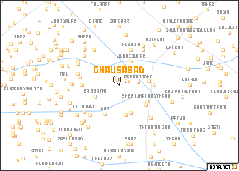
Ghausābād (Sind, Pakistan)Ghausābād is a town in the Sind region of Pakistan. An overview map of the region around Ghausābād is displayed below.
regional and 3d topo map of Ghausābād, Pakistan ::
Ghausābād airports ::
The nearest airport is SKZ - Sukkur, located 65.3 km south east of Ghausābād.
Other airports nearby include MJD - Moenjodaro (85.9 km south), SUL - Sui (106.4 km north east), RYK - Rahim Yar Khan Sheikh Zayed (198.4 km east), WNS - Nawabshah (208.6 km south), Nearby towns ::
Partābābād (1.1km north east) //
Gul Muhammad (1.4km north east) //
Jāfar Khān Mundrāni (2.5km north) //
Rabban Odho (2.6km east) //
Lāl Bakhsh Khosa (3.0km north) //
Jahānpur (3.8km south west) //
Jumme Buhar (4.1km north east) //
Raīs Sāthi (3.8km south west) //
Lāl Bakhsh (4.2km east) //
Lāl Muhammad (4.6km south) //
Goth Nīl Wāh (4.7km south) //
Sher Muhammad Thahim (4.5km south east) //
Dao (4.9km south west) //
Nazarpur (4.8km south east) //
Ghulām Khān (4.9km east) //
Bājhāni (5.8km north) //
Tāj Muhammad Khān (5.2km west) //
Lāiq Malghāni (5.6km west) //
Chutalābād (6.2km south west) //
Somānpur (6.4km north east) //
Allāh Bakhsh Roda (6.0km west) //
Sher Muhammad (6.6km north west) //
Goth Dāro (6.4km south west) //
Ālam Khān Thahin (6.7km south east) //
Moghairi (7.0km north east) //
Bhāi Khān (6.7km north west) //
Muhammad Sāleh (6.7km north west) //
Khair Muhammad Burra (6.5km west) //
Azīzullāh Khosa (6.8km north west) //
[all distances 'as the bird flies' and approximate]  Places with similar names to Ghausābād, Pakistan ::
Disclaimer :: Information on this page comes without warranty of any kind |
||
|
Where is Ghausābād? Elevation and coordinates ::
Latitude (lat): 28°6'0"N Longitude (lon): 68°17'0"E
Elevation (approx.): 53m (map arrows pan, magnifying glasses zoom) |
||
|
Visiting Ghausābād? Hotel/Accommodation ::
Book a hotel in Ghausābād Travel Guide ::
Buy a travel guide for Pakistan rental cars ::
car rental offers GPS waypoint ::
download a GPX waypoint (PoI) of Ghausābād for your GPS receiver
|
||