|
search place name
|
||
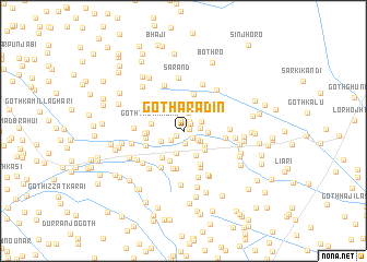
Goth Ārādīn (Sind, Pakistan)Goth Ārādīn is a town in the Sind region of Pakistan. An overview map of the region around Goth Ārādīn is displayed below.
regional and 3d topo map of Goth Ārādīn, Pakistan ::
Goth Ārādīn airports ::
The nearest airport is WNS - Nawabshah, located 45.7 km north west of Goth Ārādīn.
Other airports nearby include BDN - Talhar (123.7 km south), MJD - Moenjodaro (164.2 km north), SKZ - Sukkur (195.9 km north), KHI - Karachi Jinnah Intl (196.8 km south west), Nearby towns ::
Goth Allāhdād (0.6km east) //
Duthro (0.8km south west) //
Goth Sujāwal Khān Laghāri (1.0km north east) //
Goth Lāl Khān Laghāri (1.1km north east) //
Goth Fateh Muhammad Junejo (1.1km north) //
Goth Umar Beg Khān (1.1km south east) //
Goth Budhal Khān Laghāri (1.2km south) //
Goth Subhān Ali Shāh (1.4km south west) //
Goth Ghulām Husain Bhutto (1.6km east) //
Kora Kato (1.7km south east) //
Goth Jāffar Khān Laghāri (1.9km north) //
Goth Mithu Khān Mehtla (1.9km south east) //
Goth Palli Laghāri (1.9km north east) //
Lāndhi (2.4km south) //
Goth Kamāl Khān Laghāri (2.2km east) //
Goth Sobho Khān (2.3km south west) //
Goth Ali Khān Mehtla (2.5km south east) //
Goth Kora Kāri (2.7km south east) //
Goth Muhammad Mubārik Mehtla (2.8km south east) //
Goth Taur Wasān (3.0km west) //
Goth Shāhu Brāhui (3.3km south) //
Goth Ismāil (3.4km south west) //
Goth Buzdār Khā Muhammad Sarewāl (3.3km west) //
Goth Shāhīn Rind (3.7km south east) //
Goth Karīm Bakhsh (3.8km north) //
Goth Khair Muhammad Sarewāl (3.5km west) //
Goth Ali Khān Sarewāl (3.6km west) //
Goth Jokhia (3.9km south) //
Goth Mubīn Wasān (4.0km south) //
[all distances 'as the bird flies' and approximate] 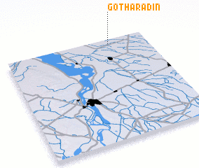 Places with similar names to Goth Ārādīn, Pakistan ::
// Goth Rouddin (PK)
Disclaimer :: Information on this page comes without warranty of any kind |
||
|
Where is Goth Ārādīn? Elevation and coordinates ::
Latitude (lat): 25°57'15"N Longitude (lon): 68°44'25"E
Elevation (approx.): 22m (map arrows pan, magnifying glasses zoom) |
||
|
Visiting Goth Ārādīn? Hotel/Accommodation ::
Book a hotel in Goth Ārādīn Travel Guide ::
Buy a travel guide for Pakistan rental cars ::
car rental offers GPS waypoint ::
download a GPX waypoint (PoI) of Goth Ārādīn for your GPS receiver
|
||