|
search place name
|
||
Goth Hāji Jān Muhammad Rind (Sind, Pakistan)Goth Hāji Jān Muhammad Rind is a town in the Sind region of Pakistan. An overview map of the region around Goth Hāji Jān Muhammad Rind is displayed below.
regional and 3d topo map of Goth Hāji Jān Muhammad Rind, Pakistan ::

Goth Hāji Jān Muhammad Rind airports ::
The nearest airport is WNS - Nawabshah, located 74.9 km north west of Goth Hāji Jān Muhammad Rind.
Other airports nearby include BDN - Talhar (99.7 km south), MJD - Moenjodaro (192.9 km north west), KHI - Karachi Jinnah Intl (199.4 km south west), SKZ - Sukkur (220.1 km north), Nearby towns ::
Goth Mehrāb Chāndia (1.7km south east) //
Goth Mallo Bhīl (1.9km north east) //
Goth Mittho Māchhi (1.9km north west) //
Goth Nāga Bhīl (2.6km north) //
Goth Dīno Joneja (2.6km north west) //
Goth Hāji Khān Muhammad (2.7km south west) //
Goth Hāji Qaisar Khān (2.7km north west) //
Goth Qāsim (2.9km north east) //
Deh Twenty-seven (2.9km south west) //
Goth Bhīri Kolhi (3.4km south) //
Deh Ghanwar Khān (3.3km south west) //
Goth Bachi Khoso (3.6km north) //
Goth Mīru Mangro (3.5km north east) //
Deh Sixty (3.6km east) //
Bhīri (4.3km south) //
Goth Gul Hasan Marri (4.4km south) //
Goth Sāhib Khān (4.5km north) //
Hāji Khair Muhammad (4.2km west) //
Goth Dīwān Chand (4.6km south west) //
Goth Jaryo Khoso (4.5km north west) //
Goth Hāji Khoso (4.4km north west) //
Goth Sākho Khāskheli (4.8km south east) //
Goth Manthār Janeja (4.9km north east) //
Sāndal Chāndio (5.7km south) //
Patoyūn (5.2km east) //
Goth Abdul Mālik Baloch (5.8km north) //
Goth Sher Muhammad Sandher (5.6km south west) //
Goth Jaryo Bhambhro (6.0km north) //
Goth Bagga Kolhi (6.1km south) //
[all distances 'as the bird flies' and approximate] 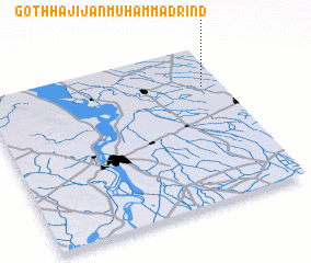 Places with similar names to Goth Hāji Jān Muhammad Rind, Pakistan :: Disclaimer :: Information on this page comes without warranty of any kind |
||
|
Where is Goth Hāji Jān Muhammad Rind? Elevation and coordinates ::
Latitude (lat): 25°44'20"N Longitude (lon): 68°55'0"E
Elevation (approx.): 20m (map arrows pan, magnifying glasses zoom) |
||
|
Visiting Goth Hāji Jān Muhammad Rind? Hotel/Accommodation ::
Book a hotel in Goth Hāji Jān Muhammad Rind Travel Guide ::
Buy a travel guide for Pakistan rental cars ::
car rental offers GPS waypoint ::
download a GPX waypoint (PoI) of Goth Hāji Jān Muhammad Rind for your GPS receiver
|
||