|
search place name
|
||
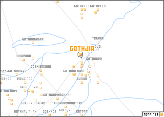
Goth Jia (Balochistān, Pakistan)Goth Jia is a town in the Balochistān region of Pakistan. An overview map of the region around Goth Jia is displayed below.
regional and 3d topo map of Goth Jia, Pakistan ::
Goth Jia airports ::
The nearest airport is SUL - Sui, located 111.4 km south east of Goth Jia.
Other airports nearby include SKZ - Sukkur (170.3 km south), UET - Quetta (171.4 km north west), MJD - Moenjodaro (203.1 km south), Nearby towns ::
Goth Imām Bakhsh (0.9km south) //
Goth Mīr Dost (1.2km south) //
Goth Sādiq (1.9km south) //
Lahri (2.5km north east) //
Goth Dilāwar Arāin (2.5km south east) //
Goth Mīroi (2.5km south west) //
Goth Hāra (2.6km east) //
Goth Jhanda Khān (3.4km south east) //
Goth Naubat (3.7km south) //
Goth Wāsu (3.9km south) //
Goth Karīm Dād (4.0km south) //
Gugi (3.7km north east) //
Baghdār (4.0km north east) //
Burra (4.0km south east) //
Goth Mochiān (4.0km south west) //
Goth Jāni Khān (4.0km south east) //
Goth Wazīrān (4.3km south) //
Trehar (4.9km north east) //
Goth Muhammad Alī (5.2km south east) //
Tuniān (5.6km south) //
Goth Mīr Husain (6.4km south east) //
[all distances 'as the bird flies' and approximate]  Places with similar names to Goth Jia, Pakistan ::
Disclaimer :: Information on this page comes without warranty of any kind |
||
|
Where is Goth Jia? Elevation and coordinates ::
Latitude (lat): 29°10'0"N Longitude (lon): 68°12'0"E
Elevation (approx.): 126m (map arrows pan, magnifying glasses zoom) |
||
|
Visiting Goth Jia? Hotel/Accommodation ::
Book a hotel in Goth Jia Travel Guide ::
Buy a travel guide for Pakistan rental cars ::
car rental offers GPS waypoint ::
download a GPX waypoint (PoI) of Goth Jia for your GPS receiver
|
||