|
search place name
|
||
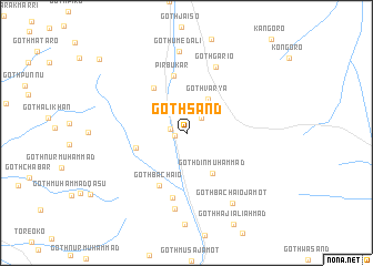
Goth Sānd (Balochistān, Pakistan)Goth Sānd is a town in the Balochistān region of Pakistan. An overview map of the region around Goth Sānd is displayed below.
regional and 3d topo map of Goth Sānd, Pakistan ::
Goth Sānd airports ::
The nearest airport is KHI - Karachi Jinnah Intl, located 98.1 km south of Goth Sānd.
Other airports nearby include WNS - Nawabshah (155.2 km east), MJD - Moenjodaro (212.2 km north east), BDN - Talhar (218.3 km south east), SKZ - Sukkur (285.5 km north east), Nearby towns ::
Goth Mulla Hassan (1.1km west) //
Goth Muhammad Siddique (1.5km west) //
Goth Ibrāhīm (2.1km north east) //
Goth Oso (3.5km north east) //
Goth Varya (3.9km north east) //
Goth Din Muhammad (4.8km south east) //
Goth Yār Muhammad Jāmot (4.8km west) //
Goth Mob Ali (5.3km north west) //
Pīr Bukar (5.8km north) //
Goth Bachaio (5.8km south west) //
Goth Allāh Bakhsh Jāmot (6.7km south) //
Goth Gario (7.1km north) //
Goth Usmān Jāmot (7.7km south) //
Goth Umed Ali (8.2km north) //
Goth Bāchāio Jāmot (8.3km south east) //
Goth Ibrāhim (10.9km north west) //
[all distances 'as the bird flies' and approximate] 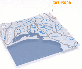 Places with similar names to Goth Sānd, Pakistan ::
// Goth Sānd (PK)
Disclaimer :: Information on this page comes without warranty of any kind |
||
|
Where is Goth Sānd? Elevation and coordinates ::
Latitude (lat): 25°45'55"N Longitude (lon): 66°55'25"E
Elevation (approx.): 289m (map arrows pan, magnifying glasses zoom) |
||
|
Visiting Goth Sānd? Hotel/Accommodation ::
Book a hotel in Goth Sānd Travel Guide ::
Buy a travel guide for Pakistan rental cars ::
car rental offers GPS waypoint ::
download a GPX waypoint (PoI) of Goth Sānd for your GPS receiver
|
||