|
search place name
|
||
Gūjar Kote (North-West Frontier, Pakistan)Gūjar Kote is a town in the North-West Frontier region of Pakistan. An overview map of the region around Gūjar Kote is displayed below.
regional and 3d topo map of Gūjar Kote, Pakistan ::

Gūjar Kote airports ::
The nearest airport is SDT - Saidu Sharif, located 55.7 km east of Gūjar Kote.
Other airports nearby include PEW - Peshawar Intl (114.5 km south), JAA - Jalalabad (135.6 km south west), MFG - Muzaffarabad (174.0 km south east), ISB - Islamabad Chaklala (195.4 km south east), Nearby towns ::
Kas (0.9km north west) //
Wādat (1.0km south east) //
Gor (1.0km south east) //
Topasīndh (1.2km north west) //
Lālu (1.2km south west) //
Plāno Derai (1.2km east) //
Stāra (1.4km north west) //
Nāgotal (1.5km south east) //
Derai (1.7km north) //
Shagai (1.7km north) //
Nambātai (1.9km south) //
Zānrai (1.8km north west) //
Gāwarkat (2.0km north) //
Manshai Kandar (2.1km south) //
Swarogal (2.2km north west) //
Shāhbekai (2.6km north) //
Pūlai (2.4km north east) //
Beragām (2.3km east) //
Karākar (2.7km north east) //
Maidān Bāndai (2.8km south east) //
Lar Mirgām (2.8km north east) //
Gal (3.0km north west) //
Dīdanpura (3.0km north west) //
Bar Mirgām (3.0km north east) //
Burkhānai (3.3km south) //
Kandai (2.9km north west) //
Bāgh Bānda (2.8km east) //
Kas (3.2km north east) //
Makhranai (3.7km south) //
[all distances 'as the bird flies' and approximate] 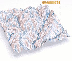 Places with similar names to Gūjar Kote, Pakistan ::
// Gujarkot (IN)
Disclaimer :: Information on this page comes without warranty of any kind |
||
|
Where is Gūjar Kote? Elevation and coordinates ::
Latitude (lat): 35°0'5"N Longitude (lon): 71°47'15"E
Elevation (approx.): 1295m (map arrows pan, magnifying glasses zoom) |
||
|
Visiting Gūjar Kote? Hotel/Accommodation ::
Book a hotel in Gūjar Kote Travel Guide ::
Buy a travel guide for Pakistan rental cars ::
car rental offers GPS waypoint ::
download a GPX waypoint (PoI) of Gūjar Kote for your GPS receiver
|
||