|
search place name
|
||
Gulāb Khel (Federally Administered Tribal Areas, Pakistan)Gulāb Khel is a town in the Federally Administered Tribal Areas region of Pakistan. An overview map of the region around Gulāb Khel is displayed below.
regional and 3d topo map of Gulāb Khel, Pakistan ::

Gulāb Khel airports ::
The nearest airport is JAA - Jalalabad, located 131.7 km north of Gulāb Khel.
Other airports nearby include PEW - Peshawar Intl (144.2 km north east), KBL - Kabul Intl (176.9 km north west), PZH - Zhob (220.6 km south), Nearby towns ::
Zira Khel (0.5km north west) //
Titai Kili (0.9km north east) //
Kāka Ziārat (1.8km east) //
Kān Ziārat (1.8km east) //
Man Zhāwar (3.0km west) //
Dardoni (3.5km south east) //
Ata Muhammad (4.1km north) //
Mcwaki Gara (5.3km south) //
Kot Ghulām Jān (4.8km south east) //
Kot Faqīr Hasan (5.2km south east) //
Kot Shakain (5.5km south east) //
Spolalai (7.1km south west) //
Barre Raghza (7.3km south west) //
Pasta Pal (7.9km south west) //
Dreplare (7.4km east) //
Bāla Khel (8.8km south) //
Sir Kamar (8.3km south west) //
Shaudat (8.6km south west) //
Tapākai (9.7km south west) //
Dabgay (9.9km north west) //
Zargar (10.4km south west) //
[all distances 'as the bird flies' and approximate] 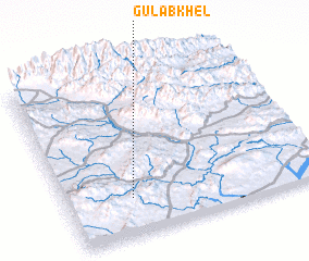 Places with similar names to Gulāb Khel, Pakistan ::
// Golāb Khēl (AF)
Disclaimer :: Information on this page comes without warranty of any kind |
||
|
Where is Gulāb Khel? Elevation and coordinates ::
Latitude (lat): 33°13'47"N Longitude (lon): 70°15'26"E
Elevation (approx.): 848m (map arrows pan, magnifying glasses zoom) |
||
|
Visiting Gulāb Khel? Hotel/Accommodation ::
Book a hotel in Gulāb Khel Travel Guide ::
Buy a travel guide for Pakistan rental cars ::
car rental offers GPS waypoint ::
download a GPX waypoint (PoI) of Gulāb Khel for your GPS receiver
|
||