|
search place name
|
||
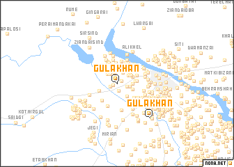
Gula Khān (North-West Frontier, Pakistan)Gula Khān is a town in the North-West Frontier region of Pakistan. An overview map of the region around Gula Khān is displayed below.
regional and 3d topo map of Gula Khān, Pakistan ::
Gula Khān airports ::
The nearest airport is PEW - Peshawar Intl, located 143.5 km north east of Gula Khān.
Other airports nearby include JAA - Jalalabad (156.6 km north), PZH - Zhob (207.4 km south west), KBL - Kabul Intl (214.1 km north west), SDT - Saidu Sharif (262.7 km north east), Nearby towns ::
Khwāja Mīr (0.6km south west) //
Shinkandai (0.9km north) //
Nadamān (0.8km north east) //
Raza Khān (1.2km south) //
Muhammad Khel (1.1km south west) //
Miān Khel Kili (1.7km north) //
Abdul Rahmān (1.5km south east) //
Sanām (1.7km north west) //
Hājīgulān (1.8km north east) //
Māuladād (1.7km east) //
Lāl Gul (2.1km north west) //
Arzimān (2.0km north west) //
Garhi Saiyidān (1.9km north east) //
Mīr Akbar Garhi (2.1km north east) //
Ghalāi (2.1km north west) //
Kotkai Bozi Khel (2.2km north east) //
Dāūd Shāh (2.4km north east) //
Imām Shāh (2.3km south east) //
Allāhdād Khān (2.2km south east) //
Mātam Khel (2.3km north east) //
Makhmad Ālam (2.5km north west) //
Shānir (2.5km north west) //
Shāh Zamāni (2.2km east) //
Sanobar Shāh Garhi (2.3km north east) //
Masti Khel (2.6km north) //
Samand Khān (2.4km north east) //
Gala Khel (2.9km north) //
Mara (2.7km north west) //
Tor Kili (2.8km north east) //
[all distances 'as the bird flies' and approximate] 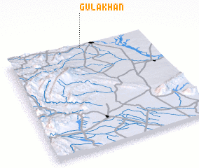 Places with similar names to Gula Khān, Pakistan ::
// Kalaguhan (PH)
// Kalakahan (PH)
// Küllükhan (TR)
// Galukhino (RU)
// Golukhino (RU)
// Golykhino (RU)
// Galah Khāneh (IR)
// Galeh Khāneh (IR)
// Galeh Khūn (IR)
// Gol Khāneh (IR)
Disclaimer :: Information on this page comes without warranty of any kind |
||
|
Where is Gula Khān? Elevation and coordinates ::
Latitude (lat): 32°59'17"N Longitude (lon): 70°32'37"E
Elevation (approx.): 397m (map arrows pan, magnifying glasses zoom) |
||
|
Visiting Gula Khān? Hotel/Accommodation ::
Book a hotel in Gula Khān Travel Guide ::
Buy a travel guide for Pakistan rental cars ::
car rental offers GPS waypoint ::
download a GPX waypoint (PoI) of Gula Khān for your GPS receiver
|
||