|
search place name
|
||
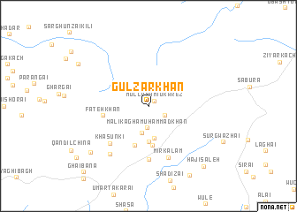
Gulzār Khān (Balochistān, Pakistan)Gulzār Khān is a town in the Balochistān region of Pakistan. An overview map of the region around Gulzār Khān is displayed below.
regional and 3d topo map of Gulzār Khān, Pakistan ::
Gulzār Khān airports ::
The nearest airport is UET - Quetta, located 88.9 km south of Gulzār Khān.
Other airports nearby include KDH - Kandahar (136.4 km north west), Nearby towns ::
Mulla Hāmid Kārez (0.9km north east) //
Malik Muhammad Khān (2.0km south east) //
Malik Āgha Muhammad Khān (2.8km south) //
Farākhi (3.5km south) //
Sirki (4.1km south) //
Mānda Chīna (4.5km south) //
Tirwah (5.0km south) //
Farākhi Dola (5.2km south) //
Fateh Khān (5.1km west) //
Nāsir Shahīd (6.6km south) //
Khāsunki (6.2km south west) //
Mīr Kalām (6.8km south) //
Mulla Sadīq (7.4km south west) //
Khwāja Maddūd (8.6km south west) //
Takhoi (9.8km south east) //
Hāji Sāleh (9.6km south east) //
Wulgai (9.2km north west) //
Ghaibāna (10.9km south west) //
[all distances 'as the bird flies' and approximate]  Places with similar names to Gulzār Khān, Pakistan :: Disclaimer :: Information on this page comes without warranty of any kind |
||
|
Where is Gulzār Khān? Elevation and coordinates ::
Latitude (lat): 31°1'40"N Longitude (lon): 67°10'5"E
Elevation (approx.): 2362m (map arrows pan, magnifying glasses zoom) |
||
|
Visiting Gulzār Khān? Hotel/Accommodation ::
Book a hotel in Gulzār Khān Travel Guide ::
Buy a travel guide for Pakistan rental cars ::
car rental offers GPS waypoint ::
download a GPX waypoint (PoI) of Gulzār Khān for your GPS receiver
|
||