|
search place name
|
||
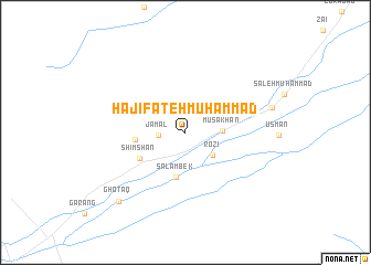
Hāji Fateh Muhammad (Balochistān, Pakistan)Hāji Fateh Muhammad is a town in the Balochistān region of Pakistan. An overview map of the region around Hāji Fateh Muhammad is displayed below.
regional and 3d topo map of Hāji Fateh Muhammad, Pakistan ::
Hāji Fateh Muhammad airports ::
The nearest airport is PJG - Panjgur, located 183.9 km south west of Hāji Fateh Muhammad.
Other airports nearby include UET - Quetta (273.4 km north east), Nearby towns ::
Jamāl (2.5km west) //
Rozi (3.4km south east) //
Mūsa Khān (3.3km east) //
Salāmbek (4.6km south) //
Patwār Khāna (4.6km west) //
Sher Muhammad (4.7km north east) //
Shimshān (4.9km south west) //
Hāji Muhammad Husain (8.1km east) //
Ghotaq (9.2km south west) //
[all distances 'as the bird flies' and approximate] 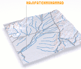 Places with similar names to Hāji Fateh Muhammad, Pakistan ::
// Hāji Fateh Muhammad (PK)
// Hāji FatehMuhammad (PK)
Disclaimer :: Information on this page comes without warranty of any kind |
||
|
Where is Hāji Fateh Muhammad? Elevation and coordinates ::
Latitude (lat): 28°20'25"N Longitude (lon): 65°9'30"E
Elevation (approx.): 670m (map arrows pan, magnifying glasses zoom) |
||
|
Visiting Hāji Fateh Muhammad? Hotel/Accommodation ::
Book a hotel in Hāji Fateh Muhammad Travel Guide ::
Buy a travel guide for Pakistan rental cars ::
car rental offers GPS waypoint ::
download a GPX waypoint (PoI) of Hāji Fateh Muhammad for your GPS receiver
|
||