|
search place name
|
||
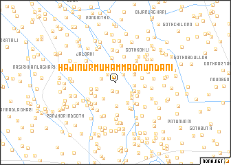
Hāji Nūr Muhammad Nundāni (Sind, Pakistan)Hāji Nūr Muhammad Nundāni is a town in the Sind region of Pakistan. An overview map of the region around Hāji Nūr Muhammad Nundāni is displayed below.
regional and 3d topo map of Hāji Nūr Muhammad Nundāni, Pakistan ::
Hāji Nūr Muhammad Nundāni airports ::
The nearest airport is BDN - Talhar, located 46.4 km south of Hāji Nūr Muhammad Nundāni.
Other airports nearby include WNS - Nawabshah (118.1 km north west), KHI - Karachi Jinnah Intl (179.4 km west), BHJ - Bhuj (231.8 km south), JSA - Jaisalmer (267.3 km north east), Nearby towns ::
Bachal Khān Nadāni Goth (1.5km south) //
Goth Dharam Chand (1.6km south) //
Akbarābād (1.7km north east) //
Sukheo Māchhi (1.7km north west) //
Bāno Wadero (2.2km west) //
Wali Muhammad Khāskheli (2.8km east) //
Abdullāh Hālepoto (2.9km south east) //
Goth Hasno Kapri (3.0km south east) //
Goth Hayāt Laghāri (3.0km west) //
Hāji Sumār Khāskheli Goth (3.2km south west) //
Bachal Khāskheli (3.1km north east) //
Noshehra (3.1km south east) //
Sharīfābād (3.3km north west) //
Dilāwar Khāskheli (3.3km north east) //
Kamāl Hālepoto (3.4km south east) //
Goth Bachal Aresar (3.7km south east) //
Goth Rahīm Rind (3.9km south) //
Mewa Laghāri Goth (3.6km south west) //
Hāji Chāng Goth (3.7km south east) //
Bashīrābād (4.1km north) //
Goth Sattābo (3.8km west) //
Ghulāmu Chāng Goth (3.9km south east) //
Goth Sobhāgo Khāskheli (4.0km south west) //
Sāwan Waryān (4.0km east) //
Chāng (4.4km north) //
Goth Muhammad Yūsuf (4.4km south east) //
Ahmad Pīr Goth (4.5km south west) //
Goth Hasan Hāle Poto (4.7km south east) //
Kāra Bhīl (4.4km east) //
[all distances 'as the bird flies' and approximate] 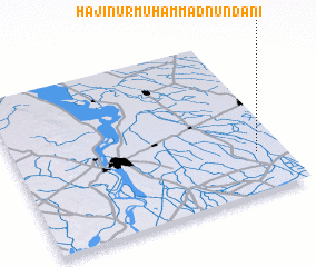 Places with similar names to Hāji Nūr Muhammad Nundāni, Pakistan :: Disclaimer :: Information on this page comes without warranty of any kind |
||
|
Where is Hāji Nūr Muhammad Nundāni? Elevation and coordinates ::
Latitude (lat): 25°15'25"N Longitude (lon): 68°53'50"E
Elevation (approx.): 20m (map arrows pan, magnifying glasses zoom) |
||
|
Visiting Hāji Nūr Muhammad Nundāni? Hotel/Accommodation ::
Book a hotel in Hāji Nūr Muhammad Nundāni Travel Guide ::
Buy a travel guide for Pakistan rental cars ::
car rental offers GPS waypoint ::
download a GPX waypoint (PoI) of Hāji Nūr Muhammad Nundāni for your GPS receiver
|
||