|
search place name
|
||
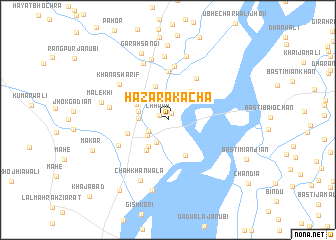
Hazāra Kacha (North-West Frontier, Pakistan)Hazāra Kacha is a town in the North-West Frontier region of Pakistan. An overview map of the region around Hazāra Kacha is displayed below.
regional and 3d topo map of Hazāra Kacha, Pakistan ::
Hazāra Kacha airports ::
The nearest airport is PZH - Zhob, located 129.1 km west of Hazāra Kacha.
Other airports nearby include MUX - Multan Intl (162.8 km south), Nearby towns ::
Babar Kacha (0.8km north east) //
Chhanb (1.0km north west) //
Jhok Māchhi (2.2km south west) //
Jhok Haqdād (2.5km north east) //
Jhok Mahmūd Khān (2.7km south west) //
Jhok Jāna Jarh (2.6km south west) //
Babar (2.8km west) //
Chāh Hussain Khān (2.9km west) //
Jhok Sak (3.4km south west) //
Chāh Sheikhwāra (3.5km north west) //
Chāh Hussain Khān (3.9km north) //
Jhok Kārla (3.8km north east) //
Basti Dhāndla (4.0km south west) //
Dhondlawāli Jhok (4.3km south) //
Paroa (4.1km west) //
Jhok Ramzān Khān (5.4km north) //
Thath Sohlan (5.3km north east) //
Gurmāni (6.1km north) //
Jhok Wazīr Korai (5.5km south west) //
Jhok Gaunsar (5.7km west) //
Khāna Sharīf (6.1km north west) //
Ghaus Shāh Janūbi (6.7km north) //
Nāivela (6.9km north) //
Jatta (7.1km north) //
Chāh Khānwāla (7.2km south) //
Jhok Jhandīr (7.4km north) //
Malekhi (6.6km west) //
Garah Sāngi (7.9km north) //
Miali Basti (8.0km south) //
[all distances 'as the bird flies' and approximate]  Places with similar names to Hazāra Kacha, Pakistan :: Disclaimer :: Information on this page comes without warranty of any kind |
||
|
Where is Hazāra Kacha? Elevation and coordinates ::
Latitude (lat): 31°34'15"N Longitude (lon): 70°47'57"E
Elevation (approx.): 162m (map arrows pan, magnifying glasses zoom) |
||
|
Visiting Hazāra Kacha? Hotel/Accommodation ::
Book a hotel in Hazāra Kacha Travel Guide ::
Buy a travel guide for Pakistan rental cars ::
car rental offers GPS waypoint ::
download a GPX waypoint (PoI) of Hazāra Kacha for your GPS receiver
|
||