|
search place name
|
||
Hiral (Sind, Pakistan)Hiral is a town in the Sind region of Pakistan. An overview map of the region around Hiral is displayed below.
regional and 3d topo map of Hiral, Pakistan ::

Hiral airports ::
The nearest airport is BDN - Talhar, located 99.1 km south west of Hiral.
Other airports nearby include WNS - Nawabshah (134.4 km north west), JSA - Jaisalmer (205.4 km north east), MJD - Moenjodaro (241.8 km north west), Nearby towns ::
Deh Four (2.4km south east) //
Kot Sulaimān (2.8km south) //
Qāzi Nūr Muhammad (3.4km south west) //
Abdul Hakīm (4.3km south) //
Hāji Dilāwar (4.9km south east) //
Ādam Pali (5.5km south east) //
Gorāhdi (5.6km south west) //
Kalri (7.0km south east) //
Shāhali Khān Qarāi (7.4km south) //
Goth Hondo Ārīsar (7.1km west) //
Ghulām Nabi Shāh (7.5km north east) //
Hāji Sāwan (8.0km south) //
Mubārak Pali (7.9km south east) //
Sūfi Faqīr (9.0km south east) //
Qāzi Nūr Muhammad (9.2km south east) //
Nabi Bakhsh (9.4km south west) //
Mīr Muhammad (9.6km south east) //
Korinjo (9.2km south east) //
Gāhi Khān Gahlro (9.7km south west) //
[all distances 'as the bird flies' and approximate] 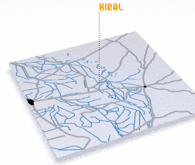 Places with similar names to Hiral, Pakistan ::
Disclaimer :: Information on this page comes without warranty of any kind |
||
|
Where is Hiral? Elevation and coordinates ::
Latitude (lat): 25°31'0"N Longitude (lon): 69°29'0"E
Elevation (approx.): 11m (map arrows pan, magnifying glasses zoom) |
||
|
Visiting Hiral? Hotel/Accommodation ::
Book a hotel in Hiral Travel Guide ::
Buy a travel guide for Pakistan rental cars ::
car rental offers GPS waypoint ::
download a GPX waypoint (PoI) of Hiral for your GPS receiver
|
||